Thursday, December 30, 2010

A Lake Explore; Citizen Science using Project Noah App

Between the subzero wind chills of Vermont winter and a big project deadline, I'd been spending far too much time inside in the past few weeks.  With the deadline passed and an early winter thaw building in, it was time to get outside.  I decided to take a walk on the shores of Lake Champlain.  In addition to getting outside, I wanted to take advantage of the 'balmy' 33 degree air to try out Project Noah, a citizen science app for the Iphone.

The air temperature has been below freezing for most of December, but Lake Champlain is large and deep, and the wide portion of the lake near Burlington, Vermont has not frozen over.  The splashing waves deposit ice on everything near the lake, including branches, rocks, and even fences.

IMG_0972.JPG

Click below to take a virtual tour of my walk, using Project Noah.


Monday, December 27, 2010

Thinking of Flowers in Winter

December has been a stormy month in a lot of places.  California was pounded with heavy rains and mountain snows, Atlanta experienced a white Christmas, many areas near the Great Lakes were buried in lake effect snow, and now a raging nor'easter is pounding the New England area.  Burlington, Vermont appeared to have missed the storm but in the last hour or two, we have been pounded by heavy snow, howling north winds, blizzard conditions and a wind chill of well below zero Farenheit.  It looks like we'll end up getting several inches of snow (though mostly piled in drifts) but nothing like what is happening closer to the coast.

It's important to enjoy the stark beauty of winter, but it is also important to remember that spring is waiting on the other side of it.  In the midst of all this cold, and with the dead of winter still ahead of us, it seems like a good time to think about flowers.  So, below are a few plants native to the northeastern United States that do well in rain gardens.


Iris versicolor - blue flag iris - photo from Sylvania Natives in Squirrel Hill

Sunday, December 19, 2010

Flooding in Southern California

A series of very powerful and wet storms are moving into southern California.  These storms are similar to the storms that hit the area in January, 2005, when I lived in Malibu and was dodging mudslides for a couple of months.

The storms will probably cause flooding, especially on Wednesday.  If you live in southern California, make sure to stay safe and don't drive across any flooded roadways!  It seems like every time there is flooding in that part of the world someone tries to drive across a flooded roadway and is swept away. 

It will be interesting to see how some of the new rain gardens and bioswales deal with all this water.

In the long term, the rain will be a good thing.  In addition to bringing up a lot of flowers this spring, some parts of the Sierras may pick up to 15 FEET OF SNOW!  This snow will be a huge addition to the snowpack, and for once, California may not be short on water this year.

Wednesday, December 15, 2010

Has the polar jet stream lost track of the North Pole?

The polar jet stream has been acting a bit odd lately.

Usually it rotates around the north pole (thus its name).  Ripples and waves bring storms to the 'temperate' regions of the Northern Hemisphere; areas north of the jet stream are cold while areas south of the jet stream tend to be warm.  Sometimes it splits into two separate streams, or loops of it pinch off, and create 'cutoff lows' (a type of storm that is very hard to predict).  Still, it pretty much always makes its looping way with the North Pole as its center.


The above picture, from Wikipedia, shows the normal jet stream.  Right now though, the jet stream is doing something different.

Monday, December 13, 2010

More Place-Based Technology

The turbulent weather of this fall is translating into a turbulent winter as well.  After picking up several inches of snow last week, Vermont was struck with a storm that blue in with snow and slush, followed by an inch of drenching rain.  Now, the cold air has bumped back in and it's snowing again.  We're expected to pick up about as much snow as the rain washed away - around 4 inches in the valleys, more in the mountains.  This storm has lead to great conditions for watching water move around, if not great conditions for hiking or driving.  As winter comes on though, there is so much to see and document!


Thursday, December 9, 2010

End of semester crunch; more apps

It's the end of the semester, and I'm really busy. So busy in fact that I haven't made a blog post this week. I am actually typing this from an iPhone on a bus so this entry is going to be a short one.

Winter has arrived in Vermont and Pittsburgh. Both areas have received significant snow, and Vermont hasn't been above freezing in about a week. It seems like an odd time to think about wandering around outside documenting creek flow, but of course this is exactly what I have been doing, in between final projects and grading papers. I've managed to get a few vermont creeks on the Creekwatch app. My friend also showed me two other apps - project Noah and epicollect. Project Noah is an app similar to creekwatch, except that people photograph and report animals, plants, and fungi instead of creeks. It's a really neat idea but I haven't had time to do much with it quite yet. Epicollect is a make your own type app... Later thus month I hope to make a Slow Water epi-app and try that out too.

More to follow soon!

Thursday, December 2, 2010

Phase Change, Part I

I spent some of the long Thanksgiving weekend at the shore in Connecticut, where the temperatures were relatively warm.  Driving back to Vermont on Saturday we mostly traveled under blue skies and scattered clouds, with temperatures above freezing.  This all changed when we crossed over the Green Mountains.  When we reached the eastern side of the mountains it was lightly snowing.  When we crossed over the divide, the snow intensity increased, and in Rutland, in the Champlain Valley, we were faced with a full-on snow squall.  It was fast moving, and localized, and we soon drove through it.  Under the snow squall, there was significant snow accumulation but once we passed through the storm, and found the sunshine on the other side, only patches of snow remained.

Aug 12 Rain 006

As winter builds in, many areas, such as Vermont, we experience many days where the temperature fluctuates above and below freezing.  This causes water to change between a solid and a liquid form, and do lots of interesting things in the process.  Fluctuation of a compound between forms in this way is known as phase change.

Tuesday, November 23, 2010

Saving California

California has had quite a bit of trouble lately, and there is a lot of attention being drawn to the economic/housing crisis.  This crisis is a big deal, don't get me wrong.  We need to fix it.  Lurking beneath it, though, is something a lot more sinister.  Although it bubbles to the surface from time to time, it really isn't in the public consciousness.  Yet, it has the potential to possibly drive California into famine and war that has not been seen in the United States since the days of the Civil War.  Do you think I am being overdramatic?  Well, I hope I'm wrong, too.

Humans are adaptable, smart, tough, and stubborn. As a species, as a culture, we can get through a lot of incredibly harsh times.  The bottom line is, though, that we can not, and will not, survive without enough water.

Confluence

Disclaimer 1: These views reflect my views only and are not associated with my project in Pittsburgh or anything happening in Vermont.

Disclaimer 2:  A lot of what I am going to say here seems impossible, from a political standpoint.  It probably is impossible, without major cultural and social changes.  It would be hard... but not as hard as going without food and water.

Disclaimer 3: This is really long.  I should be working on grad school work, so I should not have just typed this all out.

Monday, November 22, 2010

Neat Iphone App for Monitoring Watercourses: "Creek Watch"

I just learned about a very neat app from the LA Creek Freak blog.

The CreekWatch app, developed by IBM, allows you to take photros of a creek and report the amount of water and whether or not there is any trash present.

(picture from the Iphone App Store)


Friday, November 19, 2010

City of Pittsburgh Online Map Viewer

Are you interested in maps and GIS but don't have access to ARCMAP?  Do you live in Pittsburgh?  If so, check out this City of Pittsburgh Maps website.  This website allows you to check out some different GIS data layers of the city, including zoning maps, road maps, aerial photos, and even wooded areas.  I don't see sewers or historic stream channels on here yet, but there's no reason they can't be added at some point.

One of the most interesting things I noticed while perusing these maps is that almost all of the areas that are forested are also 'landslide danger areas'.  This really demonstrates how important trees are in stopping erosion and landslides.  It also really illustrates the fact that trees were mostly preserved in areas that were hard to develop.  When pondering the nature left in the refugia amongst the city, we should also think about welcoming nature back into flatter areas as well, amongst our homes and businesses, instead of banishing it to our steep slopes.

Anyway, check out the maps, and see what you can discover on your own!

Wednesday, November 17, 2010

Panther Hollow Run Watershed Map on Google Maps!

Remember the Historic Channels of Squirrel Hill map I made last summer?  I've made a draft version of this map that is viewable on Google Maps!


View Panther Hollow Lost Channels V1.0.kmz in a larger map

(Be patient, it can be slow to load.)

The dark blue lines are existing watercourses, the light blue lines are historic watercourses I found on old maps, and the yellow lines are places where I think surface water once flowed, based on hydrology, but did not see on historic maps.  The light red outline is the current Panther Hollow Run watershed and the maroon line is the part of the watershed that drains into the combined sewer-stormwater system.  There are a few other features thrown in too.  Click on the features on this map for more info.

Over time I hope to expand this map over the whole Four Mile Run watershed and add other features.  Ultimately it will hopefully expand to be a big part of the outreach I am working on for my project.

I am currently looking at ways to get this on the version of Google Earth on 'smartphones', so that people can actually pull up this map while in the watershed and see where historic channels are.  Stay tuned...

Wednesday, November 10, 2010

Freezing Rain in Vermont, Autumn in Pittsburgh's Urban Ecosystems

Being from southern California, and having only spent a bit over a year in Vermont, there are a lot of cold-weather things I just haven't experienced.  Southern California has high mountains that can get quite a bit of snow, but few people live in the mountains; for most people, time in snow is an optional recreational activity, not a way of life.  Here in Vermont, of course, the cold winters are a huge part of the landscape and culture, and are a defining feature on the landscape.

Last Monday, Burlington experienced a short period of freezing rain.  While this was not a major ice storm by Vermont standards, it was fascinating to me because I've never experienced freezing rain before.  (We didn't happen to get any freezing rain last year, and it is quite rare in California, even in areas that get lots of snow).

_IMG_0705

Wednesday, November 3, 2010

Water slows down for the season

Yesterday I spent the day in the Adirondacks.  The spatterings of snow that moved through the area, and did not accumulate near Lake Champlain, did stick around at the higher elevations.  At the mid elevations, the ground was too warm to allow snow to stick around, but the vegetation was not.  Snow accumulated on the spruce, on downed logs, even on lichen... clearly demonstrating that trees don't just intercept rainfall, but also slow down water of a more icy sort.

IMG_0641

Wednesday, October 27, 2010

Scalable Water and a Big Storm

Due to being very busy this will be a short post.  There are, however, two neat things I wanted to share.

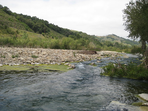
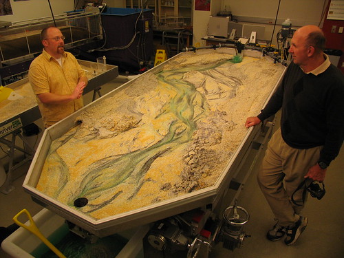
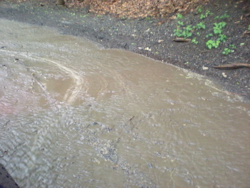
One of my favorite things about water is how scalable it is.  A small trickle in sand will act much the same was as the Earth's largest rivers do.  Yesterday I was exploring a gravel pit for a geology class (and learning about eskers!) when I found this 'delta'.

IMG_0550

IMG_0543

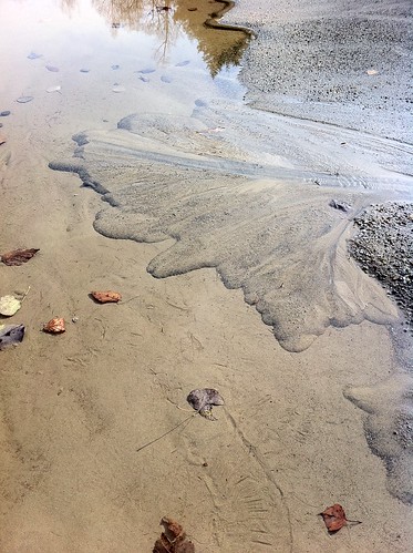
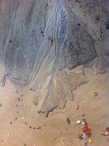
It had many of the same features of a large river delta.  By altering the flow of the little trickle of water (creating a dam and then breaking it), we were able to watch the delta experience high water events, and shift its channels.  Then, I lowered the level of the 'lake' about an inch by using a shovel to drain the puddle.  The water began cutting into the little delta and creating a new delta at the new water level.  Soon, the entire geology class was involved.  Unfortunately, as is usually the case when many humans are trying to modify the flow of water, by the time we left the little delta was mostly destroyed.  Don't feel bad though because it rained last night and probably built itself back in that time.

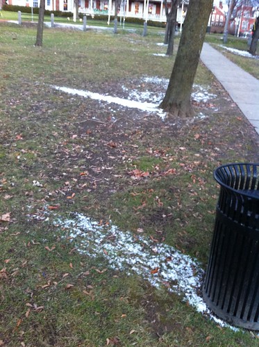
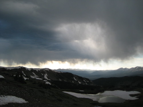
Speaking of which... the rain last night in Vermont was quite mild.  I hear that in Pittsburgh, there was a moderate storm, but nothing particularly intense.  The large weather system responsible for this was anything but mild in other parts of the Midwest, however.  According to Jeff Masters' blog, this storm was the strongest on record in the interior United States in terms of barometric pressure (hurricanes and nor'easters can still be more intense than this storm was).  It led to tornados, severe thunderstorms, and also winds near hurricane force on Lake Superior. 

There have been an awful lot of intense storms lately, perhaps due to long-term changes in the climate, or perhaps due to other factors we don't understand.  There are some indications that this winter could be quite a stormy one, and may be a winter of very heavy snowfall in many places.  It's time to prepare for winter, as the squirrels are doing right now as well.
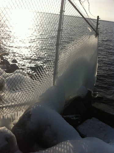
Thursday, October 21, 2010

More about Beavers in Southern California

Beavers have been on my mind lately, as evidenced in the long post I made about them yesterday.  As mentioned in that post, beavers have huge positive effects on watersheds, and their removal has caused drastic effects that we can't even understand the full effects of.  I have wondered if beavers were present in some of the more protected perennial streams (or streams that would be perennial with beaver meadows) of southern California.  In fact, today I found evidence that in fact beavers did inhabit at least one more wild southern California stream.

Wednesday, October 20, 2010

The Beaver: Our Slow Water Animal Ally

Us humans sure have an inflated sense of importance!  Since we are the ones who created pavement, rooftops, and channelized culverts, we think we are the only ones who can also work to slow down water with rain gardens, bioswales, and constructed wetlands.  It's time to face up to the truth.  There is another mammal who has been constructing wetlands and 'rain gardens' since long before humans even set foot in North America.  In truth, they do a better job of it than us, too.  Unfortunately, humans have done a good job of driving these animals away from much of the United States in the last 500 years.  The good news is that they are already on the comeback, and all they ask in return for their work is a little bit of space, tolerance, and some delicious aspen and willow to chew on.

happybeaver


Wednesday, October 13, 2010

A Pond of Two Watersheds

Although there are many sub-watersheds within every watershed, it is very rare for an area to be part of more than one watershed.  Water that falls on the Earth and flows downstream generally has only one possible path to follow as it flows downhill (unless it evaporates or is used by living organisms).  In particular, it is quite unusual for a pond to drain into two watersheds.  For this to happen, the pond has to be right on the peak of a drainage divide!  (If you think of a watershed as similar to a tree, a pond draining into two watersheds would be like a single apple growing on two trees at once).  However, in Vermont, there is a pond called Sterling Pond that is perched right on the main divide of the Green Mountains!  Water from this pond flows both into the Winooski River (via the east side of the mountain range) and the Lamoille River (via the west side of the mountain range). 

IMG_0428[1]

Wednesday, October 6, 2010

It's the First Day of Spring in Los Angeles

It sounds absurd to say, but in effect it is true, if you define spring as the season of growth and renewal.  The first rains of the cold season have arrived in southern California. Click below to read more about the turn of the seasons in the place I lived before I moved to Vermont.

Monday, October 4, 2010

"Super Rainstorm Nicole" Strikes East Coast

On September 30 and October 1, heavy rains affected much of the east coast from North Carolina to Vermont.  In eastern North Carolina the rains were extremely intense, and some areas received more than 20 inches of rain!  The rain was not quite as severe as that in Vermont but most areas still received over 3 inches of rain (there were around 3 inches of rain in Burlington, 4 in Middlebury, and around 5 in Rutland, for instance.  Christopher Bert, an extreme weather expert, has named this rain event 'Super Rainstorm Nicole' because it was in part fed by short-lived Tropical Storm Nicole.  Visit this blog for more info on this storm and its similarities to rainfall associated with Hurricane Hugo in 1999.

The storm caused widespread minor flooding in Vermont, but a major disaster was avoided, probably in part because most of September was rather dry.  Nevertheless, the rivers were filled to the brim by this rainstorm.  Here's what Otter Creek in Middlebury looked like on Friday morning:

_IMG_0329

Wednesday, September 29, 2010

Flooding Rains Still Possible in Vermont

Just as a quick update, flooding rains are still in the forecast for Vermont and other areas of the East Coast tomorrow.  A tropical storm is expected to quickly form, and then zip north from South Carolina bringing heavy rain along its path.

*** note: images removed because they no longer are relevant - NWS has updated/changed the links. More info on the storm soon.***

These storm systems are small in size and hard to predict so this is not an easy forecast.  Needless to say, however, anyone from New York State south to South Carolina should be ready for the possibility of some very heavy rain.

I am hoping the downpour (if it happens) doesn't ruin the fall foliage!

Monday, September 27, 2010

Rainy times in Vermont

Rainy times have come to Vermont.  After a relatively dry late summer, fall is arriving, and is bringing copious rain.  As I type this it is raining outside, and it has been for most of the day.  It will be raining on and off for much of the rest of the week too, and if some computer models are correct, it could be very rainy indeed.

VermontRain

Monday, September 20, 2010

Four Mile Run Watershed Workshops; Change of Seasons.

If you live in the 4-Mile Run watershed or another urban watershed in Pittsburgh, you should consider attending these workshops!

Meanwhile, in Vermont, fall has arrived.  While it is not 'officially' fall for two days, this morning was greeted by 'almost-frosty' dew, ground fog, and slightly more fall color than the day before.  The changing of the seasons has become quite evident here, even though peak foliage is still quite far off.

Fall is coming!


Wednesday, September 15, 2010

Urban Seep Soil Science

This week I decided to investigate the urban seeps of UVM in greater detail.  Since seeps come from underground, it makes sense to look at the soil!  I took out one of our trusty soil probes and took some samples!  I'm not sure exactly what I found means, but it adds another piece to the seep puzzle.

College Street Seep core

Sunday, September 12, 2010

Slow the Flow video

Earlier this week I went and did more investigation of the two urban seeps I mentioned last week.  I've got more to share about them... but in the mean time, I thought I'd share this video that was posted on the LA Creak Freak site.  It's called Slow the Flow and talks about ways to reduce runoff in Southern California.  While specific plants and other design elements may not work elsewhere (for instance, it does not snow in this part of southern California), the general ideas are very much relevant to any area with human-constructed structures.

I haven't watched it quite yet so let me know if you like it or not.  If it's a good video I'll have to link to it more in the future.

Monday, September 6, 2010

A Tale of Two (urban) Seeps

When I think of seeps, I usually think of water dripping down a mossy hillside in the forest.  All it takes to create a seep, though, is a place where water that soaks into the ground is forced out again, usually by bedrock or impervious clay beneath it.  Although they are less common in urban areas, because the presence of pavement and rooftops makes it harder for water to soak into the ground in the first place, they are sometimes found in the city, especially in cities that get a lot of rain and/or snow.


Small Seep


Tuesday, August 31, 2010

Great news for Panther Hollow and the 4 Mile Run Watershed!

The Pittsburgh Parks Conservancy just received a 1 million dollar grant to go towards restoring Panther Hollow Lake and the Panther Hollow Watershed!  Half the grant will be used to provide funding for a watershed management plan while the other half will go towards necessary management and maintenance projects.

Read more at the Pittsburgh Parks Conservancy website.

Monday, August 30, 2010

Bioswales near Jeffords Hall in Burlington, Vermont

The new Jeffords Hall building on the University of Vermont campus in Burlington, Vermont includes some landscaping designed to slow down runoff and infiltrate it into the groundwater.  Runoff from the area would otherwise probably end up in Centennial Brook, the Winooski River, and then Lake Champlain. 

Bioswale near Jeffords

This area collects water from a roadway.  It isn't really a rain garden since there are drains in the low spots, but this landscaping still allows some of the runoff to slow down and enter the soil.

Bioswale near Jeffords

close-up!

Bioswale near Jeffords
This large area has a small constructed 'creek' flowing through it.  I think it could have used a few more meanders but it is still a nice feature.

It has been fairly dry since I got back to Vermont, but I will be documenting how these features and others nearby respond to rainfall and snow.

Thursday, August 26, 2010

Destruction of a Man-Made Lake

It has been well established that destruction of natural habitat can have a variety of negative social, ecological, and cultural effects. What about completely unnatural systems in a place they would never occur naturally? What happens when these are destroyed?  Although not natural ecosystems, they can still be very valuable to the local community.
These issues recently came up in the urban desert near Phoenix, Arizona, when Tempe Town Lake was destroyed by failure of an inflatable dam.

Tuesday, August 24, 2010

Exploring Centennial Woods

Located in Burlington, Vermont and adjacent to the University of Vermont, Centennial Woods is a small patch of nature (around 65 acres according to the university website) that is owned by UVM and used for research and for recreation by the public.  The woods are small and frequently visited, but they are full of very neat places to explore.  I wander around in this area as often as I can, sometimes several times a week, and during all seasons and types of weather.  It is one of my favorite places.  It also shares some interesting similarities to Schenley Park in Pittsburgh.

Entrance


Thursday, August 19, 2010

A few neat links about urban nature

Through some research and through people sending me links, I've found a bunch of neat websites I wanted to share here, involving urban nature and watersheds.  Check them out below the pretty picture of Lake Champlain.

Burlington Sunset


Tuesday, August 17, 2010

Back in Burlington, Vermont

My summer visit to Pittsburgh has ended and I am back in Burlington, Vermont.  As I will be posting about Burlington as well as Pittsburgh on this blog, I wanted to give a bit of a background...

Church Street During Rain
(Church Street in downtown Burlington during a fall rain)

Friday, August 13, 2010

Impressive Impervious Bridge Runoff Event

So there's a lot of talk about 'Impervious Surfaces' - areas such as roads and rooftops that cover large areas in cities and are impervious to water - meaning, basically, that water does not soak in when it hits them, but runs off instead.  I have definitely mentioned this in the blog before, but this far in Pittsburgh I hadn't been out in the park during a full-on summer downpour.  Yesterday, in my last few days in Pittsburgh for the summer, I was in the right place at the right time.

Bridge Downspout


Wednesday, August 11, 2010

Fallingwater and Ohiopyle

A couple of weeks ago I went to visit Fallingwater, a house designed by Frank Lloyd Wright near Ohiopyle, Pennsylvania.  This house was built to be fully integrated into the landscape, including a creek and waterfall.  Because I am interested in how people connect to their landscapes, especially in the case of flowing water, I thought this would be a great place to visit.

The information they gave me asked that pictures taken by the public not be put on the internet, so here's a public domain photo from Wikipedia:


Monday, August 9, 2010

Who Owns the Rain?

In most of the norteastern United States and adjacent Canada, there is abundant precipitation, and plenty of water.  In fact, the Great Lakes alone contain about 84 percent of North America's fresh water.  Most rainwater management consists of moving the water away from buildings and roads so it doesn't cause problems.  But what about places where water is scarce?  Do you own the water that falls on your home?
Cottonwood Pass and Storm Clouds 2

Saturday, August 7, 2010

Gulf Dead Zone Update; Leaving Pittsburgh In A Week

Last month I made a post about the gulf dead zone - an area in the Gulf of Mexico that contains very little sea life, due to input of nutrients from the Mississippi River.  According to information I have read in the past, the main contributors of these nutrients are agricultural areas in the vast Mississippi River watershed.  However, I also found an EPA study that indicates that sewage discharges (even treated ones) may be a larger factor.  I'm not sure which is the leading cause, but it is safe to say that stormwater/sewage overflows as well as runoff from landscaping in Pittsburgh and other cities in this large watershed contribute at least a small bit to this.

Recently I found a New York Times blog entry indicating that the Gulf Dead Zone was particularly large and problematic this year.

In any event, 'slow water' practices that encourage water to soak into the ground or flow through streams and wetlands are one of the best ways to reduce the amount of these nutrients in runoff.  Ironically the nutrients themselves are great for plants - it's only a problem when too much of these vital nutrients enter waterways where they don't belong.  Projects like the possible 4-Mile Run Daylighting project in Pittsburgh help reduce this problem in two ways: by reducing the number of stormwater sewage discharges into the rivers, and by allowing wetland and creekside plants to filter nutrients out of the water.  Constructed wetlands are also great when placed between treated sewage discharges and rivers, because sewage treatment plants can't remove all of the nutrients from the river.

This summer has been a hot one so far, but there are signs that its peak has passed.  At least one maple tree thinks it is time to start turning red:
Early
I think this maple tree may be a bit premature.  However, in exactly 1 week, my time in Pittsburgh is ending for now and I will be driving back to Vermont where I will continue working on outreach for the Pittsburgh Park Conservancy while attending classes at UVM.  I intend to keep this blog going, with posts relating to Vermont, to Pittsburgh, and to anywhere else where I learn neat things about runoff management and water flow.  I want to thank everyone in Pittsburgh I have talked to for their input and support.  If anyone has any thoughts on this blog, please do leave a post or email me.  At some point, a similar blog may be created specifically for the 4-Mile Run watershed.  This blog, however, will hopefully follow me wherever I go.

Wednesday, August 4, 2010

Cobblestones And Dead Batteries: Rain Exploration #2

In June I visited Schenley Park during a rainstorm.  However, most of Four Mile Run and other watersheds in Pittsburgh is not parkland, so I thought it would be interesting to watch what rain does in an urban area as well.  A line of thunderstorms presented a chance of doing this today.  I chose the corner of Bartlett Street and Murdock Street in Squirrel Hill, because this is part of the historic Panther Hollow Run and because there are several different types of pavement in this area.

Sure enough, the weather started getting stormy fast.

Squirrel Hill Storm Clouds


Monday, August 2, 2010

Gigapan Training in Schenley Park

Yesterday I attended a Gigapan training around Panther Hollow in Schenley Park.

A Gigapan training?  I'm sure some people are probably wondering what a Gigapan is...

A Gigapan is a neat little device that allows you to take very high resolution pictures using a regular point-and-shoot camera.  It was developed right here in Pittsburgh.  (note that the Gigapan picture on that website is of Schenley Park!)


Friday, July 30, 2010

Stream Tables!

One of the things I love about flowing water is that it is so scalable - a little stream flowing through sand acts the exact same way a huge river does in the same circumstances.  I just happened across some really neat looking stream tables at this website.  These could be a great outreach tool.  Granted, as a graduate student I can't afford to buy one of these, but maybe some day I can get one or make one on my own.

Emriver Em4 at Winona State

Doesn't this look fun?

Thursday, July 29, 2010

Ask Me About This Watershed!

As mentioned in a previous post, I thought it might be fun to walk around Schenley Park and adjacent areas in a shirt that says 'Ask Me About This Watershed!' and see if anyone actually asked me.  So... I did it!

IMG_0156


Monday, July 26, 2010

Atlas of Runoff Management Projects

In The Watershed, a great blog about a watershed in the Los Angeles area, just posted a link to a really neat atlas of Low Impact Development (LID) projects focusing on runoff/water management across the country.  This project is being conducted by the National NEMO Network based out of the University of Connecticut.  This is a great site and I am having a lot of fun scrolling around the map and looking at projects in different places.

I immediately noticed that there are no projects from the Pittsburgh area on the map!  Hopefully I can help to remedy this soon!

If anyone else knows of similar sites, or of additional blogs I should link to, definitely let me know!

Sunday, July 25, 2010

Cedar Creek Park and Middle Mon

It isn't really possible to fully understand an urban watershed without knowing what the natural and rural context or this area is and was.  Last month I went to McConnells Mill State Park.  Although beautiful, that area, with its history of glaciation and slightly higher/more northern location, was not all that similar to Schenley Park.  In fact, with the presence of white pine, yellow birch and copious beech and hemlock, it reminded me more of Vermont than Pittsburgh.      Last week I went to Cedar Creek Park, which is a bit less wild and remote, but a bit more similar to the forests currently and historically found near Pittsburgh.  I also drove home along the Monongahela River.

Saturday, July 24, 2010

Heat and Summer Storms

Last night a very impressive line of thunderstorms formed in northern Ohio and Pennsylvania.  There was some very impressive and beautiful lightning in Pittsburgh's northern sky, flashing through much of the extraordinarily hot night.

Tonight there is a similar line of storms, only a bit closer and a bit faster moving.  There is again lightning to the north, though less impressive at the moment.  Perhaps I will still be able to take a few more pictures.  In any event, I sure hope this time the rain makes it here.  It's been dry and hot, and some rain sure would be nice.

The storm currently has 60 mile per hour winds in it, though, so watch out if you're outside tonight.

My next post will be about an explore of the 'Middle Mon Valley', hopefully tomorrow.

Friday, July 23, 2010

CMU: Man Made Localized Rain and Water Landscaping

I was walking through CMU the other day, one of the recent days where thunderstorms were building but no rain had yet fallen.  Yet, despite the lack of rain, I came across an area of water dripping off the Fine Arts Building.

_DSCN1582


Thursday, July 22, 2010

Followup on Dry Times and Touch-me-not

In yesterday night's blog entry I mentioned some Pale Touch-me-not that was wilted, and speculated that it could be due to the hot, relatively rain-free conditions.  I was exploring Cedar Creek Park (near Donora) today and saw something that makes me think that the plants 'wilt' due to heat or direct sunlight but not due to lack of water.

IMG_0025.JPG

I found a plant that was half in the sun and half in the shade.  The sunny side (on the right) had 'wilted' curled up leaves and the shady side (on the left) did not!  Since the plant gets all its water from the same root system (and also because it had recently rained in that area), it is very unlikely that the plant was wilting on only one side due to lack of water.  Instead, it is probably curling its leaves to reduce the effects of heat and sunlight.

There were many other plants in direct sun, which were also 'wilty', and in shade, which were not.

I'll have more thoughts on my visit to Cedar Creek Park soon!

Wednesday, July 21, 2010

Dry Times in Panther Hollow

Earlier this week I was in Panther Hollow on a warm, sunny afternoon.  It hadn't rained substantially in a few days and it really showed. 

_DSCN1566


Monday, July 19, 2010

"Ask Me About Your Watershed" Project?

After wandering around Schenley Park a bunch of times and almost always getting into interesting conversations with random people, I thought it might be fun to initiate a mini-project where I encourage people to talk to me. While I am not particularly shy, it is often difficult to initiate conversations with random people, especially in urban settings (in rural Vermont it would often be rude NOT to!).

Anyway, my idea was to make some sort of sign, or even a shirt (probably a blank white one drawn on with sharpie), to wear when i am wandering around the 4 mile run watershed. At best, it might encourage some great conversation and at worst, people will ignore me and I can go poke around in the creek.

Sunday, July 18, 2010

More Thoughts on Slow Water in Southern California

Although ecologically- and socially- conscious watershed and runoff management are relevant everywhere, the methods through which one achieves these goals will vary greatly in areas of different climate and geography. Southern California, where I grew up, has turned its backs on its rivers to an extent I haven't encountered anywhere else. While the rivers in Pittsburgh struggle with pollution and access issues, many rivers in the Los Angeles area - even the mainstem channels - just don't exist as rivers anymore, but are instead routed into giant gutters like this one I posted last week.

The sprawling nature of cities in Southern California may offer many opportunities for small-scale stormwater management solutions such as rain gardens. However, this same sprawl has eaten away at almost all of the space that could be used to restore or daylight rivers without ensuing immense costs.

Interestingly, as in Pittsburgh, Los Angeles has a lot of railroad infrastructure along it's main river(s). These people have created a proposal to build a large constructed wetland, park, and restored river section on a railroad yard. I think it's a great idea in theory, though I am skeptical that it would be possible to do this and still find enough space to operate a railway to truck transfer facility. Although rail yards are not particularly pleasant, and it is unfortunate that these facilities tend to be near watercourses, we also need space for infrastructure, and trains tend to be much more efficient in moving freight than trucks or airplanes.

Then again, I don't want to naysay what could be a really neat project, so hopefully something is figured out. It's definitely something to keep an eye on if you have any interest in southern California or in urban river restoration.

Saturday, July 17, 2010

Is Panther Hollow Run a Beheaded Channel?

The idea of a 'beheaded channel' sounds quite morbid.  In fact, it is a term used by geologists to describe a natural process that can happen to some watercourses, such as creeks that flow across a fault.  However, we have also 'beheaded' Pittsburgh's Panther Hollow Run when we routed runoff from Squirrel Hill into the sewer.  Is this a good thing or a bad thing?  In a sense, it is both.

Thursday, July 15, 2010

Slow Water Movement Facebook Page!

Update:  You can now become a fan of the Slow Water Movement on Facebook!

No tweets yet, though.

Historic Channels Part III: The 'Pit' in CMU

Has anyone wandered around on the Carnegie Mellon University campus and noticed that the tennis courts are located in a 'pit' (one T!) in the middle of campus?  There is another such formation just to the east as well.  These 'pits' are in fact remnants of a historic gulch that once cut through the area where CMU is now present.


Wednesday, July 14, 2010

Pittsburgh Parks Message Board

I wanted to post a link to a new message board set up by the Pittsburgh Parks Conservancy.  This message board is a place for community members and interested individuals to discuss issues relating to Pittsburgh parks.  Click on the Schenley Park message board and you will find a thread about my project and this blog.  There are also public message boards fro other parks in Pittsburgh.  If anyone would like to discuss the parks in a more convenient setting than the 'comments' section of this blog, check that site out.  I will be regularly checking on it, as will employees of the Pittsburgh Parks Conservancy and other community members.  If you live in or care about Pittsburgh you should use the site too!

Tuesday, July 13, 2010

Slow Water? or No Water?

I was in the Los Angeles area the last few days visiting family.  While I was driving near downtown Los Angeles, I saw something that surprised me very much - rain droplets on my windshield!

_DSCN1465

If you aren't from California, you might wonder why this surprised me.

Wednesday, July 7, 2010

More Lost Channels, an Unplanned Visit to the Monongahela

Today I was driving across town and decided to take a short detour to see a few more historic stream channels I had located on the map mentioned in this post and this one

The area is mostly urbanized, as was the case in Squirrel Hill, but I found a few fragments of urban nature, and some neat neighborhoods.  Click below to see more.


Tuesday, July 6, 2010

It's Hot!

So, anyone in Pittsburgh or nearby areas has noticed by now that it is HOT out!  Temperatures have been reaching the 90s for the last couple of days and probably will continue to do so for the next couple of days.  This temperature map from the National Weather Service has perhaps poorly chosen colors (that yellow doesn't look so bad!) but you can see from the temperature readings that it is expected to be uniformly hot throughout the region.
Hot
This may seem nasty but believe it or not it is actually hotter and more humid in parts of Vermont than in Pittsburgh.

This is where the second half of 'slow water' kicks in.


Sunday, July 4, 2010

Pre-Made Wetlands!

I've talked a bit in this blog about the benefits of creating wetlands, including water filtration and retention, wildlife/game species habitat, and recreational and aesthetic values.  One thing that is very important to remember, however, is that there are lots of 'pre-made' wetlands already in place.  In this case, they were created by glaciers, erosion, sediment deposition, and buildup of dead plant material, over thousands of years.  I am talking of course about natural wetlands, which are invaluable because they are much more diverse and stable than created wetlands, and also are great places to visit to get inspiration for created wetlands as well.  Large numbers of natural wetlands have been destroyed (well over 90% of the original area covered in wetlands has been destroyed and converted to other land uses in some places) and it is very important to preserve - and to appreciate - intact natural wetlands, and to care for not only these wetlands but the areas that drain into them.

_DSCN1337
Click below to see a photograph of some neat natural wetlands in Erie County.  They are a bit different than the ones you would have seen in the site of Pittsburgh before it was built, because Erie County was affected by glaciers during the ice age and the soils, geology, and landforms are different there.  The weather is also affected by nearby Lake Erie.  However, this will still give you a view of what some sorts of natural wetlands in western Pennsylvania look like.


Thursday, July 1, 2010

Helping Clean Up the Gulf of Mexico while in Pittsburgh.

The continuing Deepwater Horizon oil spill is big news right now - as it should be. This major oil spill has caused an incredible environmental and social catastrophe in the Gulf of Mexico, particularly in the Mississippi Delta area. This area has already been suffering a great deal of problems due to a variety of issues ranging from pollution to wetland loss and effects associated with Hurricane Katrina. A lot of people want to help out, and there are a few ways you can do that right from Pittsburgh (or anywhere else in the Mississippi River watershed ).

Monday, June 28, 2010

Four Mile Run

The historic creeks of Squirrel Hill are buried under the city, and there isn't really any room to 'daylight' them. There are,. however, historic streams right in Pittsburgh that could see the light of day again, in our lifetimes or even in the next few years, if funding and public support could be found for daylighting work...

Wednesday, June 23, 2010

Rain Garden in Action!

Today, as is the case on many summer days, Pittsburgh had a thunderstorm with lots of lightning, wind, and rain. According to the National Weather Service, there was a 59 MPH wind gust, and some places received 1 to 2 inches of rain in an hour! Where I was at, it did not appear to have rained an inch, but there was still rather heavy rain for a while. I went to check out one of the rain gardens we built two weeks ago, which is the only one that is already fully hooked up.

Rain Garden Creek

Here's a picture (sorry for the blurriness, it was dark out due to the storm). This rain garden was so effective, that water didn't make it much further than the little creek flowing from the gutter to the rain garden area. Right now it doesn't drain the whole roof, and more water may be added to it later. Nevertheless, this is the first time I got to see a Pittsburgh rain garden in action. It was great to watch since there was a comfortable porch right next to it.

Tuesday, June 22, 2010

Getting Out of Town: McConnells Mill State Park

I took a trip yesterday to McConnells Mill State Park, about 50 minutes' drive north of Pittsburgh. I wanted to see what non-urban forests looked like in this area and also thought it would be nice to get out of the city for a day.  Click 'More' to see what I found!

Sunday, June 20, 2010

Exploring Historic Channels in Squirrel Hill

Yesterday I went on a mission to look for lost streams. These lost streams once flowed through the area now known as Squirrel Hill in Pittsburgh, but now are re-routed into a combined sewage-storm drain system.

The two streams I searched for are the northeasternmost in this map I posted in my last post:

Historic Drainages of the 4-Mile Run Watershed

My approximate route can be found here.


Channels of the Past

Recently I found a bunch of historic maps of Pittsburgh, on a Pitt site called the Darlington Digital Library . These maps, spanning from the early 1800s to the mid 1900s, showed the growth of Pittsburgh and, in some cases, the locations of waterways within the growin city. As mentioned earlier, most of the 4-mile Run watershed runoff has been routed into combined sewer-stormwater runoff channels underground. I thought it would be neat to map the old creek channels on a current map of the city, so I downloaded a USGS topo map and did just that!  Click 'More' to see how it turned out.

A Weekend Installing Rain Gardens

So last weekend I helped a local community organization install five rain gardens in (near?) the Highland Park area of Pittsburgh.

As I've mentioned before, a rain garden is a garden intended to capture runoff from impervious surfaces like roofs and parking lots, and allow it to soak into the ground or be released back into the atmosphere. Rain gardens reduce flooding by slowing down water the way natural wetlands would, reduce pollution by naturally filtering runoff, and decrease the effects of drought by increasing groundwater recharge to aquifers that later release water into wells or springs. Rain gardens often use appropriately-chosen plants native to the local area, as these plants require little care and have the added bonus of providing habitat for local wildlife and beneficial insects.

This rain garden started as a small lawn:
Rain Garden 1


Note the drainspout in the background. Lawns do not absorb very much water, so whatever came out of that drainspout would rush down the hill into the gutter and then the sewer.

More pictures below:


Everyone is in a Watershed: Explorations in the Rain.

One of the things I love about runoff and hydrology is that EVERYWHERE on land is part of a watershed. When it rains, or when snow melts, water anywhere on Earth has a path it will follow, either to the ocean, or sometimes to a salt lake or salt flat. Water that falls on Pittsburgh and isn't used or evaporated ends up in the Gulf of Mexico! That is about 1000 miles by road but significantly further along the twisty Ohio and Mississippi rivers. And every bit of that huge river (except rain that happens to fall in the river itself) comes from little tiny tributaries somewhere upstream (including those that travel underground in the form of groundwater).

_DSCN1051 _DSCN1054

Water that falls on our construction materials, our parks, our rooftops, our gardens, our cars... it all eventually makes its way either to a river, or back into the air to fall somewhere else.

Yesterday (June 9th) I went to explore Schenley Park in the rain.  See more:


Storm Aftermath

Over the first week of June, as mentioned in the previous post, there were heavy rains around Pittsburgh. Over 3 inches fell between June 1 and June 5, with most of that in a few hours in two big thunderstorms. After the storms had passed, I went to Schenley Park to check out the effects of the heavy rains of the last week. There had been some fairly dramatic runoff and flooding during this time.

Delta After Storm
I took a picture of this 'delta' into Panther Hollow Lake before the storms and again after. It looks smaller in the second picture because the lake level is higher. The lake had filled up well beyond its banks and almost overflowed.

Muddy Lake
When I was at the lake, the water level had dropped to near normal but was still extremely muddy. These photos are a clear demonstration of one of the problems facing this small park watershed - upstream erosion causing siltation in this lake. At some point rather soon, the lake will either have to be dredged, which is expensive, or will stop being a lake, which means people won't be able to enjoy it anymore.

Eroded Bridge
This bridge was washed out before this storm, but additional noticeable erosion had occurred during the rains.


Building From Park
The park is pretty!

Another item of note: the atmosphere may be transitioning from El Nino to La Nina conditions. This could mean that next winter in Vermont will be much colder and icier than last winter (it may actually snow less - last winter was pretty snowy - but the snow is more likely to stick around). This would also mean a likelihood of a drier than average rainfall season in much of California. We'll see!

Storms in the City

So, there are often thunderstorms in Pittsburgh in the early summer, and this year has apparently had even more than usual. During early June there were several significant thunderstorms. The storms weren't as impressive to see moving in as those in the desert or even in Vermont, because the sky is often hazy and there are lots of trees and buildings everywhere. However, the storms were LOUD and the lightning was very impressive.

DSCN0943.JPG
One storm moves away...

DSCN0946.JPG
and another moves in. This one lasted several hours and had a ton of lightning and rain.

DSCN0949.JPG
The storms cause lots of erosion which is a problem in the parks.

Lightning4
Lightning2
Poor-quality pictures of sheet lightning from my room. There were lots of crazy bolts too but not when I was able to take videos.

These storms, along with one a few nights later, dropped over 3 inches of rain on the Pittsburgh area in the first week of June.