Thursday, December 27, 2012

Happy Holidays... and a New Home for Slow Water Movement

A heavy snowstorm is slamming Vermont - the heaviest we have seen since March of 2011 because last year's winter was such a dud.  I came home from my travels a day early to avoid the storm, and so today is a good day to watch the snow fly, not drive anywhere, and be thankful for my warm, dry, safe home.

Untitled

I just shoveled our cars out, and they are buried again.  The road is snow-covered and slick, but the bakery is open and a short walk away and the woods are just a slightly longer walk, so I have everything I need.  I think this afternoon will be time to break out the snowshoes.

While I was visiting family in Connecticut, the temperature in Montpelier plunged to -2.  When I left, the river had very little ice on it, but after the subzero night, that has changed significantly.

Untitled

Connecticut didn't get as cold, but a beautiful dusting of snow fell on central portions of the state late Christmas Eve night, so the little ones got to play in the snow.  I tried a few runs myself but a crust of ice that can support a three year old wouldn't support me and I just dragged in the grass.  Oh well.  At least I got to dye some icicles and play in the snow with the kids.  Playing in the snow with young children is definitely one of life's pleasures.   They also enjoyed the colorful icicles.

Untitled

With the solstice and the new year comes change and renewal, and on that note I am excited to announce that the Slow Water Movement blog will be moving to the Coyot.es network - a new network of neat conservation-minded blogs featuring author and desert advocate Chris Clarke's Coyote Crossing blog which I've been a fan of for a long time.  The Coyot.es network is still being put together, and will feature lots of blogging about the desert, and I'm hoping Slow Water Movement's emphasis on water and on cold, wet Vermont will add to the diversity of the blog network.  There will be more to follow soon.

Here's the URL for the new Slow Water Movement blog.  I will post a couple more crossover posts and leave a link on this URL, but it would be a good time to update your bookmarks/blogrolls.

Tuesday, December 18, 2012

Return of the Snow Monster

Temperatures in central Vermont have been hovering right around freezing for the last couple of days as a series of storms passes through.  First, the forecast called for mostly snow, then for mostly rain.  As it turned out, a weather 'compromise' emerged for the Montpelier area.  Most areas of the state picked up mostly rain, but cold air trapped between the mountains meant Montpelier is picking up snow a bit faster than the rain can melt it.

Untitled

That's about the deepest it got - maybe 4 or 5 inches in favored areas.  It wasn't enough to ski in, but it was enough to revive one of my favorite silly winter traditions - the Snow Monster.

The Snow Monster started in Middlebury as a pile of snow that slid off a roof onto another pile of shoveled snow.  It survived the entire snowy winter of two years ago, and acquired arms and facial features for a while.


It suffered through thaws but survived into March and perhaps April (I did not document its final demise).


Last year I created a new Snow Monster, in East Middlebury.  The winter was very mild, so the snow monster died and was reincarnated several times.


Here's this year's snow monster:
Untitled

Untitled

It's already as big as last year's snow monster... but since we now live in Montpelier, it may not be a fair comparison.  Montpelier averages about a foot and a half more snow each year than the Champlain Valley, and more importantly, it is colder - while overall average temperatures are only about two degrees colder, this two degrees largely represents the fact that thaws borne on south winds have a hard time making it into the central part of Vermont.  They funnel right up the Champlain Valley, which is also moderated by lake temperatures until/unless the lake freezes.

So the snow monster has been reborn, and is now battling the rain.  It is on the shaded north side of the house, mostly away from rooftop drip.  Today's rain has been very cold and the snow is mostly intact.  The snow monster may increase in size tonight if the rain turns to snow (it is already mixing with sleet at the airport nearby).  This Friday it may face a larger risk at the hands of a strong storm that will probably contain a fair bit of heavy rain at its core.  But, if it starts and ends as snow like this storm did, the snow monster will probably face little threat.

We'll see!  If the snow monster makes it through this week, I think I have a good chance of keeping it alive through most of the winter.


Thursday, December 13, 2012

Just A Few Little Degrees

We all know weather forecasts are imprecise.  Some summer days are forecast to be 75, and the high temperature hits 78 instead.  No one would even notice, right?  Things like meteorology and hydrology are complicated and indefinite.

In the wide world of temperature gradients, there is one hard solid line... one that holds true everywhere.  32 degrees Fahrenheit, 0 Celsius... the freezing point of water.

This solid line amidst the uncertainty of weather makes it very difficult to predict what will fall out of the air in some storms.  If it's 32 degrees Fahrenheit, and there's no warm air higher in the atmosphere, precipitation will fall as snow.  If it's a few degrees warmer, it will fall as rain, or at least as slush.  Add to this changes in temperature associated with day and night or with cold and warm fronts, and changes in temperature as one increases in altitude, and you get a real mess.

A mess is exactly what we had last Monday in much of Vermont.  A storm hit at night when the air was cold, and it snowed at least an inch or two.  But warm air followed, and the snow quickly turned to rain.

Untitled

The rain quickly started melting the snow, turning it into slush with the consistency of concrete.  Clearing the car window was like trying to remove cottage cheese.  The landscape was briefly white and wintry, but soon converted back to what we call 'stick season'- a brown landscape with leafless trees and no snow.

Untitled

When warm air slips in over the mountains but cold air stays trapped in the valleys, or when a warm front pushes warm air over a cold air mass, things get even more complicated.  Snow falling through a warm layer of air turns to rain, but if it re-enters cold air as it falls it can refreeze and turn into sleet.  If it doesn't have time to refreeze, it can freeze when it hits a surface, causing freezing rain, also known as an ice storm in severe cases.  Extended heavy ice storms can rip huge limbs off of trees, down power lines, and turn roads and sidewalks into sheets of ice.  They are beautiful, but dangerous and destructive... true examples of the potency of winter.  I've not yet experienced a major ice storm, but I'm sure I will at some point. They do happen in Vermont though they are more common further south.

The weather models mostly predict that we will get more snow next week.  We're pretty close to that one hard line in meteorology though... and a change in the storm track could easily mean rain instead, or even an ice storm.  Most likely we'll see a little bit of everything, but mostly snow this time... which most people will be happy to see.  Then again, the storm could still miss entirely, bringing us nothing.  It wouldn't be the first time.

Speaking of storms missing entirely, southern California, which had been quite dry for the last couple of months, had a good soaking rain yesterday, and several more storms are in the forecast.  Nothing that is likely to cause flooding like some areas further north experienced recently... but enough to get the hillsides greening up and maybe get some water in the creeks.  It should be beautiful.  December rain in Vermont isn't particularly welcome, but every rainstorm in the mountains of southern California still seems like a miracle.

Wednesday, December 5, 2012

What They Don't Tell You When You Move To a Cold Place

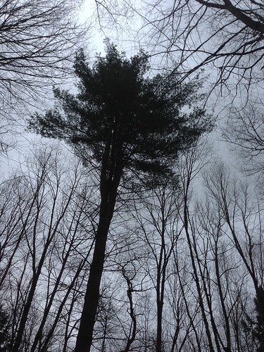
Until three and a half years ago, I had pretty much always lived in coastal California.  Sure, I went to the mountains often, and had many a fun snowboarding or sledding day, but I'd never *lived* somewhere really cold.  Visiting the snow for a weekend is a very different thing from living in a place where it often gets below zero in the winter!

IMG_0920

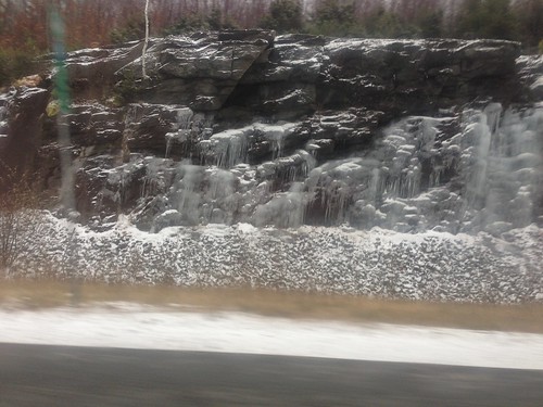
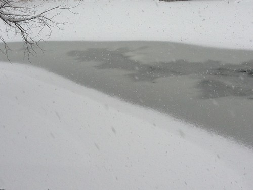
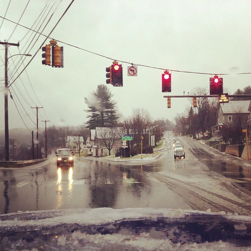
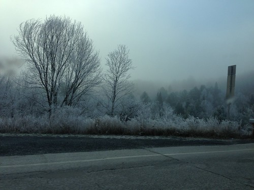
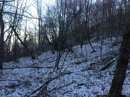
This year's winter has come on in fits and starts.  November was slightly colder than average, but included many beautiful sunny days and starry cold nights, rather than the typical cold rain, wet snow, and wintry mix. The last few days of November were very cold, with one night down in the single digits.  Now that it is December, we're back to above average temperatures, unfortunately, and have had several rainstorms mixing with puny snow flurries.  The trend is expected to continue for the next seven days, with just about every possible type of precipitation in the forecast at some point.

IMG_0915

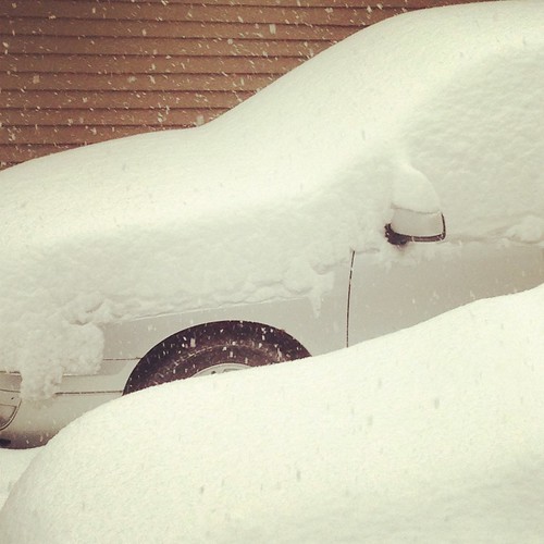
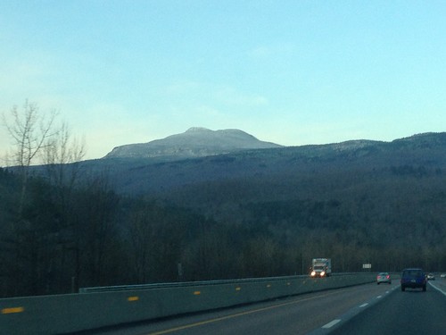
Last week, when it got down to single digits, I learned something they never told me when I moved to Vermont... but somehow it had never came up before.  My truck started up in the morning, reluctantly, but seemed ready to go.  Except... it wouldn't GO.  It dragged itself out of the driveway reluctantly, and i soon realized that one of my rear tires would not spin and was DRAGGING through the ice.

It turned out my parking brake was frozen shut.  The day before, we'd gotten wet snow and then a deep freeze.  Water got into the brakes and frozen them!

I was able to get the parking brake unstuck, but not before learning that most people in Vermont don't use the parking brake unless on a steep hill.  No one told me this!

IMG_0910

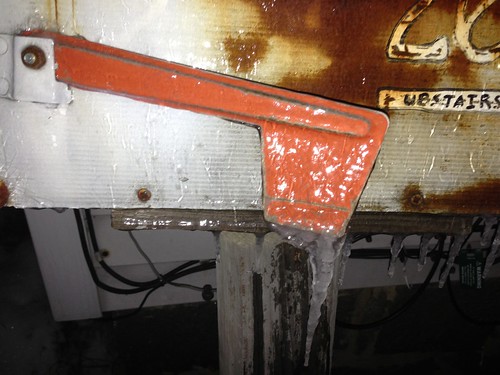
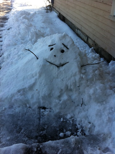
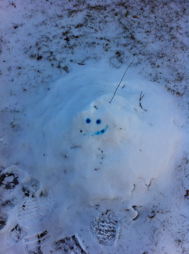
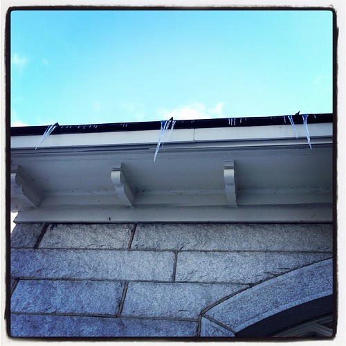
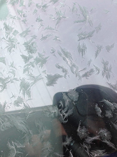
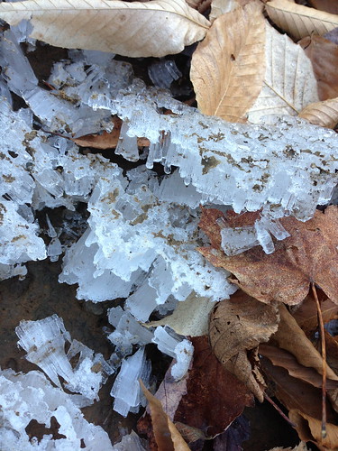
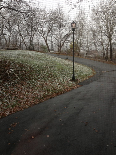
Apparently this mailbox in Montpelier was also frozen.

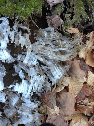
Anyway, here are a few more things I have learned, often 'the hard way', going into my fourth winter in Vermont

-A two wheel drive truck is the WORST thing to drive in the snow.  4*4 trucks are good but it helps to throw some tubes of sand in the bed to weight down the back.  Don't expect the car to stop quickly (or at all) in the ice.

-People drive two speeds on the Interstate in a snowstorm: way too fast and way too slow.  If you are behind the 'way too slow' car and try to pass, there is probably a big pile of snow between the lanes, so be ready to bust over it.

-The first few minutes the snow starts 'sticking'on the road are often the worst.  When the road is totally covered in snow... it is somewhat slick, but not the skating rink of those first few minutes...

-Often the back roads are much safer for winter storms, as long as you don't choose the steep or twisty ones.  But don't try it if you don't know the roads.  Gravel roads can be a good bet during snowstorms.

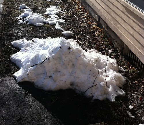
-During 'mud season' which comes as the snow and ground thaw (who knew the ground could freeze?!) , the gravel roads are to be avoided at all costs.

-If the snow is really howling, forget going where you were supposed to go, if it's not an emergency.  Walk to town and get a beer or coffee instead.  Most plans can wait, and snow is beautiful to walk in but less so to drive in.

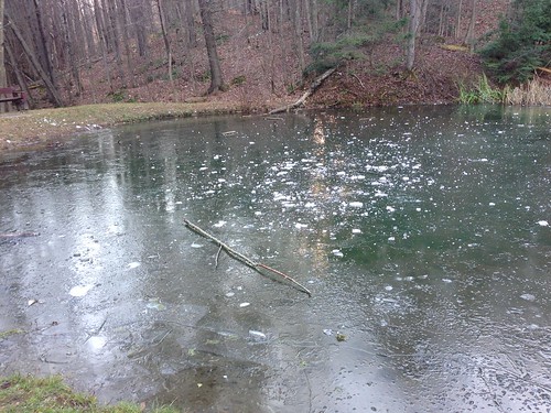
-The roads also get huge bumps on them called 'frost heaves' caused by water freezing under the road.

-Windshield washer fluid - the kind good down to -20 or colder -is essential for driving in winter.  I once drove into the Sierra in California with the type that will readily freeze.  Bad idea.

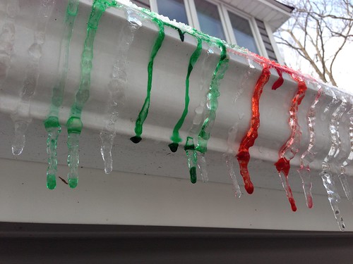
-'Wintry mix' is not an ice cream flavor and isn't as fun as it sounds.  Though I still think it is interesting.

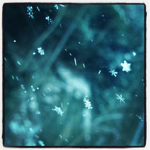
-There really are a million types of snow.

-Snow makes anything look cute.

*10F, calm, and sunny feels about 20 degrees warmer than 35F, windy, and rainy.  Just don't let your skin touch the air.

-It's possible for your nose hairs to freeze.

-You will track salt everywhere inside and it's a pain to clean.  You should always take off your shoes when you enter someone's house unless told otherwise.

-A big enough bonfire can keep you warm even at 5 degrees but if you keep your snow jacket on you won't feel the heat and it will melt.  Likewise, a house kept at 58 degrees with a warmer wood stove to stand by can seem warmer than a house kept at 68 degrees with no warmer place to stand.  I wish we had a wood stove!

-if you go for a nighttime walk on a frigid night with a beer, it will turn into a beer slurpie right in your hand.

-City snow is gross.  The piles collect garbage and dog poop and when it thaws it all comes out.

-If you're not in gross city snow, and are in good physical shape shoveling snow can actually be fun.  It's my favorite chore because I get to play in the snow and be outside.  But it is NOT fun at 6 AM if your car is plowed in.

-Many people who grew up here both love and hate the snow in the same way I both love and hate the hot sunny days in California.  Beautiful for having fun, but a nuisance for those doing physical labor outside.  55 degrees and overcast is the best conditions to work outside except for chopping wood the low 40s is great, it gets you in the mood for burning it.

-Snow actually squeaks when you walk on it, when it is really cold.  The wind also sounds different... it really howls through the branches and wires, and when the branches hit each other they 'clack' together in a really weird and eerie way.

-Vermont on a subzero night is oddly like the desert.  The air is so dry it hurts to breathe it, there are little grainy things flying everywhere, liquid water is nowhere to be found, the color green is largely absent, the quality of sound and distance are warped, and there is a stark, indescribable beauty to the air.  I've never been to the cold desert in a blizzard but I bet it is amazing.

I'm sure I will think of a ton more, and maybe those who grew up in the cold have more ideas.  Please share them here!

IMG_0911


Tuesday, November 27, 2012

Winter Weather in Vermont, Possible Flooding in California, and a new Instagram

Thanksgiving in Vermont was warm, but on the Saturday after Thanksgiving, the weather changed.  A cold blast of air flowed into the state, and intermittent snow showers dropped about an inch of snow around Montpelier.

Untitled

The Champlain Valley didn't get anything on Saturday, but Burlington picked up some snow yesterday.  Today a storm moved to our south and dropped some snow in the southernmost part of the state.  As of this morning, most areas of Vermont had picked up at least a dusting of snow.

There have also been cold nights, in some cases down to the teens (f) when the sky cleared out.

Untitled

Some icicles formed, though none I could easily color yet:

Untitled

In the cold mornings there has been some frazil ice in the river.

Untitled

Cold temperatures are expected to persist until Saturday or so... for this week it will mostly remain below freezing in Vermont, with more light snow possible.

A weather change for the whole continent is brewing in the form of a massive "atmospheric river"storm set to barrel into central and northern California in the next few days.  This storm could bring many inches of rain to parts of California, with lots of snow at the highest elevations of the Sierra.  Sadly, because the storm is forecast to get 'stuck' pointing a fire hose-like jet stream aimed at around Marin County, the rain will be concentrated in that part of the state, rather than spreading its rain over a larger area.  Southern California could use the rain and probably won't get too much.

This is a relatively warm storm, and unfortunately for those who like snow, as it moves across the country it will bring relatively warm Pacific air with it.  By the start of next week, temperatures in Vermont will be well above average, at least for a few days, with a rain storm or two to contend with.

All the temperature changes and precipitation will probably lead to some interesting water and ice events, and I'm experimenting with a new way of sharing photos, just for fun.  I created a Slow Water Movement Instagram site where I will share photos of water, ice, and general Vermont prettiness.  Check it out if you'd like.


Tuesday, November 20, 2012

Ice Returns to Vermont's Landscape

This wee's November weather in Vermont has been a surprise.  No, we haven't been besieged by hurricanes, major nor'easters, or days of frigid drizzle.  Instead, we've experienced something much less common this time of year:  abundant clear skies and sunshine.  An area of high pressure (sinking air, mostly clear skies) has been parked over the state for about a week.  The air mass has been relatively cold, and averaged out, temperatures have been below average over this period.  Still, the days have been quite warm, because the clear air allows for wide ranges in temperature between daytime and nighttime.

There have been some low clouds though - very low clouds.  The river valleys such as those around Montpelier and Barre have experienced dense freezing fog on several mornings.

IMG_0798.JPG

The fog froze on all the twigs of the trees on the hill around Berlin, Vermont, leading to this beautiful winter scene:

IMG_0803.JPG

Moisture has also been condensing on car windows.  Usually this means ice scraping - one of the less enjoyable tasks of a cold winter- but on some of the drier nights we just had pretty little ice crystal formations.

IMG_0806.JPG

I also noticed something odd on several cold mornings - one area of Barre seemed to get a dusting of 'snow' every morning.  This area is near the river, so perhaps this 'snow' is just condensed river foam, or perhaps ice crystals that fell out of the fog rising off of the river.  Certainly it is odd to see a dusting of 'snow' emerge from the fog after an otherwise clear night.

IMG_0811.JPG

IMG_0810.JPG

On a mountain trail we noticed 'frost heaves' forming.  These form when moisture seeps out of the ground as it freezes and expands.

IMG_0823.JPG

I think the layers above are formed each night as freezing and thawing conditions alternate over the day.

The 'frost flowers' or 'frost heaves' push right through the fallen leaves.

IMG_0825.JPG

IMG_0827.JPG

The larger lakes and rivers don't contain much ice but this small pond in Hubbard Park in Montpelier had some thick ice.

IMG_0842.JPG


On the slopes of the state's higher mountains, there is a dusting of snow:
IMG_0833.JPG
There is more snow to come.  The only question is how soon.  The high pressure area is forecast to leave the state after Thanksgiving Day, and a small storm over the latter half of the Thanksgiving Weekend may drop a bit of snow.  A larger storm may come in a bit over a week.  Or, maybe not.  Forecasts out that far aren't accurate.  But, I did see one computer model run that, if correct, would mean we would get possibly about 6 inches of snow.  Nothing unusual for the end of November, but more snow than we got all of last year's dud of a winter.  We'll see!

Thursday, November 15, 2012

Slow Water in Atlanta

Last week I took a few days off to visit my friend Eli in Atlanta.

We left Vermont on a frigid (15F) November morning, with snow-dusted peaks...
IMG_0589.JPG

and then after our first night in Atlanta awoke to the first frost!

IMG_0621.JPG

I guess the cold followed us.  Though, aside from chilly nights, the weather was quite warm.

My time in Atlanta was fairly limited, but I did enjoy some time obsurving urban hydrology and nature.

Atlanta is an anomaly - a city that is not built on a major river.  In fact, it sprawls over the drainage divide between the Atlantic Ocean and the Gulf of Mexico.  The Chattahoochee River flows along the western edge of the city, but near its headwaters.  In fact, despite picking up around 50 inches of precipitation a year (more than Pittsburgh, Burlington, VT, or Seattle), Atlanta has experienced some recent droughts.  Precipitation often comes as heavy thunderstorms and never as snow.  As such, the combination of copious but irregular rain and lack of a convenient consistent water source means Atlanta is a great place for rain gardens and rainwater cisterns.  In fact Eli has an enormous rainwater cistern, but I forgot to take a photo.

I did get to enjoy Piedmont Park, Atlanta's centerpiece park.  There are some fun water features as well as some unfortunate ones that remind me of Four Mile Run in Pittsburgh.  For instance, a underground creek runs in a culvert under this big field:
IMG_0610.JPG

Unfortunately it is unlikely that this part of the creek would be daylighted, because this is a popular place to hold outdoor events (I'm sure a workaround could be found, but the motivation isn't there).  However, a bit downstream there is a nice little restoration area.

IMG_0667.JPG

IMG_0669.JPG

Nearby, a recent restoration project uncovered some springs:

IMG_0633.JPG

These springs may be getting most of their water from an artificial lake just uphill from them, but they still function just like natural springs, offering habitat for a variety of animals and plants.

IMG_0644.JPG

Nearby, a culvert directed water down a concrete cascade.  I'm not a big fan of concrete in waterways but there isn't really a way to direct water down this hill on soil without massive erosion.


IMG_0657.JPG

At least it would be fun to watch the water rush down the rocks after a heavy rain.

Later we visited a tiny urban forest fragment.  Unlike in California, Atlanta hasn't frantically and intentionally turned every waterway into a sterile concrete ditch!

IMG_0726.JPG

Eli looks for big trees and helped create the Google map on that link.  There's even an iPhone app for locating Atlanta's champion trees.  We saw some huge trees in the city - probably bigger than any trees in Vermont, except for maybe a handful of big cottonwoods along the lake.  Trees grow fast in the South, where the growing season is long.  Atlanta also has fertile clay soils.

Sweet Gum:
IMG_0723.JPG

Tulip Poplar (one of the city's champions):
IMG_0689.JPG

American Beech:
IMG_0729.JPG

The beech bark disease doesn't seem prevalent in Georgia like it is in Vermont.

We also visited an area of exposed granite outside of town (they called it a Monandock but it doesn't look like the big mountains that go by that term in New England).  Despite its unimpressive stature it was a very neat place.  The exposed, smooth granite has no soil on it and strongly resembles a Utah slickrock desert.

Cactus:
IMG_0776.JPG

Yucca:
IMG_0785.JPG

"Potholes" called Solution Pools:
IMG_0773.JPG

IMG_0781.JPG

It would be very back to come back here during or right after a rainstorm, when water would be rushing down the rock and through the little gullies.  It wouldn't be safe to be out on the open mountain during one of Atlanta's raging thunderstorms, though.  A calm, cool fall rain would be more suitable.  Maybe next time!

Monday, November 5, 2012

Vermont Dusted with Autumn Snow, Mid-Atlantic Prepares for Another Storm

Yesterday was a typical November day in Montpelier, Vermont.  Slate-grey overcast skies offered the backdrop for dark brown hardwood twigs totally devoid of leaves (except the beech trees.  They retain their dry, tan leaves all winter and the leaves rattle and seem to shiver in midwinter winds).  The needles of the pines looked black against the sky, and a north wind whistled through them.

IMG_0568.JPG

The scene calls to mind one of my favorite quotes... from the book Watership Down, referring to a group of rabbits that were resigned to a horrible looming fate, and chose to stand at its whim rather than avoiding or fighting it.  The trees have no choice but to wait for the coming of winter's ice and snow.

In this case the trees didn't have to wait very long for a taste of winter.  This morning we woke up to light snow.  It picked up a bit in intensity, enough to overpower the warm ground long enough to accumulate a bit on the grass.

IMG_0570.JPG

Snow fell on the political signs...

IMG_0573.JPG

and on the new Cornerstone Pub and Kitchen in newly renovated downtown Barre.  It was far too early to go in for a beer.

IMG_0576.JPG

Just a dusting accumulated in the Barre area.

IMG_0579.JPG

The snow in Barre and Montpelier melted quite fast under the weakening November sun and above the earth still warm from Hurricane Sandy's warm conditions last week.  In the higher parts of Berlin some of the snow survived until nightfall.  With temperatures forecast to drop to the low 20s tonight I'll probably see the dusting of snow still there tomorrow morning.

I love the way these early snows tell stories about the subtle differences in temperature and precipitation across Vermont.  Snow stuck around a bit higher on the hills, just a few hundred feet above the valleys.  There were a few patches left in Montpelier but none in Barre.  Montpelier is slightly lower in elevation, but perhaps it picked up a bit more snow.  I noticed this last year as well.  It looks like last year's first snow was a bit earlier and more substantial.  Despite the earlier snow, last year turned out to be a very warm and snowless year.  I think this year will be stormier, though it's hard to say what the temperatures will do.  Montpelier tends to pick up and retain more snow than East Middlebury so I should be seeing more snow regardless.

A more substantial storm is headed our way on Thursday.  It may dump several inches of snow on us, but it will probably rain right afterwards, ruining the snow before anyone gets to enjoy it.  Sleet is also a possibility.  This sloppy mess, typical of November storms in Vermont, may offer inconvenience, but the storm is a more serious problem in areas impacted by Sandy.  This nor'easter won't be nearly as severe, but since many areas are still devastated by Sandy's effects, even a moderate nor'easter may cause additional power outages and flooding.  Hopefully the storm ends up moving a bit further east than forecast.  That could spare the midatlantic the worst of the storm, and might also give Vermont less rain on top of their second snow of the year.