Last week I got the chance to explore a sycamore floodplain forest.
Sycamores are in the genus
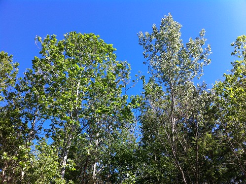
Platanus, and are distributed across most of the northern hemisphere. In Vermont as well as most of the rest of eastern North America, the species we find is American sycamore. California supports the California or Western Sycamore, and the Oriental Plane occurs in Asia and part of Europe. There are a few other sycamore species, including some that live in Mexico and one that lives in tropical Asia and is distinguished from other sycamores by being evergreen. Sycamores can often be identified from a distance by their bright white, patchy bark and pale, often fuzzy, maple-like leaves.

Above:
a California Sycamore in Solstice Canyon, California.
Most if not all of these species share something in common beyond their shared ancestry. They thrive near water, especially along rivers. From what I've observed of the California and American sycamore, both do especially well along rivers and streams that have a substrate of cobbles and gravel, move fairly fast, and vary widely in water level. The Middlebury River fits this description more fully than most Vermont rivers, and also flows through a relatively warm part of Vermont. These factors allow the American Sycamore to thrive here while it is rare in the rest of the state.

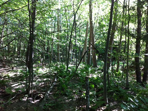
Sycamores grow along rivers in other warm parts of Vermont, but in most cases they are lined up right next to the river. The Middlebury River, and the similar New Haven River just to the north, are the only places I know of in Vermont where full floodplain forests form with sycamores as the dominant or codominant tree.
In fact, Vermont's natural community classification system doesn't have a description for sycamore floodplain forests, because they are rare and haven't been sampled enough. Part of why we were in this forest was to survey the area and determine if there is sufficient data and the forest is of sufficient size to be considered a repeatable, significant natural community in this state.
This particular forest was recently protected under an easement (see Sessions-Neil), and is a great place to study this natural community.
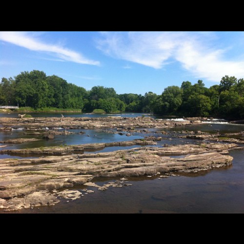
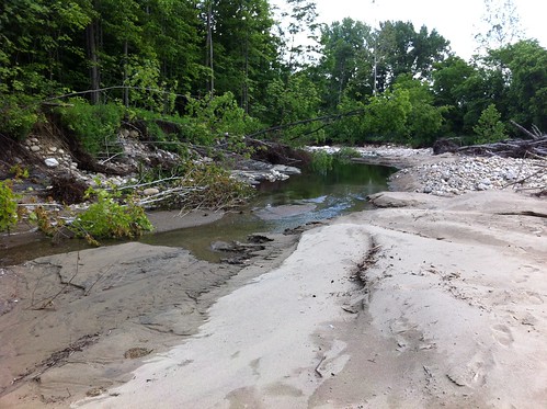
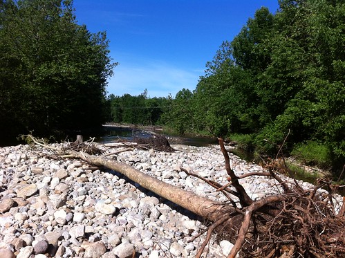
Not surprisingly, a floodplain forest experiences occasional to frequent flooding. This particular forest is defined by its recent floods. It was inundated with several feet of water during Tropical Storm Irene and again flooded during
the recent flash floods.

Above you can see swaths of sand deposited amongst the sycamores. In this area there was an inch or two of new sand deposits. Across the river I found a place where a solid layer of new sand over two feet had been deposited, by the flash floods and/or Irene.

There's been concern about sedimentation in Vermont's rivers, but it's important to note that the type of sedimentation depicted above actually decreases the severity of floods by building up the flood plain. Rivers even form '
natural levees' when they do this, which reduces the frequency of floods in flood plain areas. It's not possible for a river to build a natural levee that completely stops a flood plain from flooding, though.
The sycamores don't mind the sand deposits one bit. In fact they thrive in areas of sand deposits, as the sand brings in additional nutrients and decreases competition from trees that can't tolerate having their lower trunks buried in wet sand. The ferns and other smaller flood plain plants also grow right through the sand shortly after it is deposited (if it is during the growing season). Even more importantly, sycamores, as well as
cottonwoods, require areas of open sand to germinate. In dynamic, frequently changing river systems, new areas of sand are deposited when the river shifts or moves through the flood plain, just like it did in a very significant way during
the recent flash floods.
The river forms a conveyor belt of sorts, removing sycamores and other trees as it erodes away banks on one side, but depositing sand on the other side and providing habitat for new trees like these cottonwood saplings.

Sycamores and cottonwoods are perfectly adapted to this environment. Sure, they don't live as long as a stunted cedar tree growing out of the side of a rock outcropping. On the other hand, the river provides them with as much water and nutrients as they could ever want. They respond by growing FAST and very tall. Some of the sycamores along the river here are over 70 feet tall, and they don't even look particularly old!

Sycamores subscribe to the adage 'live fast, die young', at least compared to most other trees. As such, their trunks litter the riverbed. Since they grow so fast they don't put much energy into creating hard, strong wood, so these dead trees quickly decompose and return their nutrients to the sand.
 Quickbeam
, the 'hasty' Ent from Lord of the Rings, was described as a rowan tree but he could have also been a sycamore.
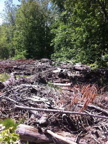
There are a lot of piles of flood debris in this section of river. They can be a bit unsightly, but most of the woody debris I saw was pushed up against the banks of the river. This slows the process of erosion, and offers habitat for numerous animals, including trout.
But what happens if the flooding stops? What if the river moves away from part of its floodplain or humans direct floodwaters away? Will the sycamores continue to grow and get enormous?
For a while... yes. The trees already in the forest would thrive. But without sand to germinate on, new seedlings wouldn't be likely to survive. Instead, other tree species might start taking over. We saw a few saplings under the sycamores in this forest:

This is sugar maple. It's a beautiful tree, and also one vital to the Vermont economy. Like sycamore, it thrives in nutrient rich soils. But, it can deal with something most other trees can't - dense shade. Sugar maples don't grow fast in the shade, but they aren't killed by it either. Over time, as openings break through the forest canopy, these saplings would make their move. Left undisturbed, this forest of 'sweet' soils would probably convert to one dominated by sugar maple, at least until they exhausted the nutrients in the soil if the river was no longer bringing them in. In areas with poorer soils, beech and hemlock, which also tolerate shade, would eventually take over.
It's very unlikely to get to that point here, though. The Middlebury River is very dynamic, and the land was specifically set aside to give the river space to move. By the time sugar maples got to the canopy, a flood would probably take them out and the sycamores would return.
Sycamores don't provide very good timber, nor do they have sweet sap. They do hold down the soil in the flood plains, and their white, puzzle-piece trunks add a unique look to this forest reminiscent of rivers much further south. They also offer dense, dappled shade that is perfect for fishing on a hot summer day. It's good that the sycamores are being allowed to retain their space in this forest. Not just for their sake either. If you see a sycamore, it almost always is growing on ground that was once riverbed. What was once riverbed will be riverbed again some time in the future. Sycamore forests are a great place to explore but not a good place to build a home.
Hopefully if we give our river enough space, while also shoring up the levees and berms on the town side of the floodplain, the river will stay amongst the pale white sycamore trunks... and not flow down East Main Street again.
 Here's a few of the species I found in the floodplain forest.