
Long range seasonal weather forecasts are very difficult to make, and often wrong. Both the most modern computer models and the oldest knowledge of long-time residents (both human and otherwise) can offer us some insight - but in many cases the forecasts still don't end up much more accurate than flipping a coin. Still, forecasts are fun, and since I'm most familiar with Vermont and southern California, I'll take a look at what some people are saying about these areas, and offer my own thoughts.
As with all long-term forecasts, please don't make plans solely on this post. Do feel free to share your own thoughts, and next spring I'll check in and see how close these forecasts came to what really happened.
Click below for the forecasts!
Weather has some 'momentum' to it, so one thing to look at is what is happening right now. Vermont has been VERY WET over most of the last year including heavy winter snow and summer rain. Last winter was cold, but not freakishly so, and last summer was not particularly hot, but was quite stormy, with Irene, several strong fronts, and a sprinkling of several severe thunderstorm outbreaks. In southern California, where winter is the wet season and summer the dry season, last winter was a bit above average in precipitation, mostly due to very heavy December storms. The summer was mostly dry, as usual, but was punctuated by a few rather unusual thunderstorm outbreaks. Temperatures were not particularly extreme one way or the other, at least from what I noticed (I don't live there anymore!).
The La Nina conditions of last winter looked like they were going to fizzle out, but instead have strengthened over the last month or two, and actually look to possibly be stronger than last year. Click here for the effects that La Nina conditions generally have on North American weather. In Vermont, La Nina generally brings near-average winter temperatures, and sometimes wetter (snowier) than average weather. In southern California, the connection is less straightforward. Because some El Nino years bring as much as double the average winter rainfall, anything other than El Nino generally brings 'below average' precipitation. However, some La Nina years have actually brought flooding (such as that during the heavy storms last December). La Nina does not seem to have a strong effect on winter temperatures in southern California, but some La Nina years have been known to bring cold snaps and unusual low elevation snowfall.
The US government is understandably reluctant to offer detailed long-term forecasts, so the NOAA climate forecasts are often less 'dramatic' than other forecast sources. This year is no exception. In Vermont, the forecast is for average temperatures (or, more specifically, an equal chance of warmer or colder temperatures than average. and somewhat above average precipitation, especially for the second half of winter. In California, the forecast is for somewhat below average temperatures, with drier than average conditions possible in the far southern and eastern edge of the state (most of which is desert that is quite dry to start with).
Two other groups that offer winter weather forecasts are the Farmer's Almanac and Accu-Weather (click for link to forecasts). Both of these forecasts are very similar for Vermont and southern California, and the forecasts are also similar to those of NOAA, albeit worded a bit more emphatically. The Vermont forecast is for weather similar to last year - average temperatures (that still means cold!) and STORMY weather with a lot of snow. Last year was one of the snowiest years on record in northern and central Vermont, and if this forecast is correct, this winter will be quite similar. In southern New England, this forecast calls for wintry mix, slushy snow, and cold rain, rather than the heavy snows of last year, but here in central Vermont, we'd get snow (except the inevitable January thaw, which can be rainy). The Accu-Weather forecast calls for more snow in early winter, while the NOAA forecast predicts wetter conditions in February and March. In southern California, both Accu-Weather and the Farmer's Almanac predict drier than average weather. This is a safe forecast to make - because the wet years can be so extreme, most years are technically 'drier than average'.
What do I think? I largely agree with the other forecasts. Vermont has been so wet and stormy for the past year, and in general the past decade has been a snowy one for the state. It seems likely that this trend will continue this year, and we will experience above average snowfall. The forecasts seem to call for 'clipper' type storms rather than nor'easters, which seems reasonable. This might mean that instead of a few dumpings, we'd get many smaller storms that keep piling on the snow. It also means that far southern Vermont might get less snow. We can probably expect one period of subzero temperatures in January or February, because a brief period of such cold weather is common even during 'average' years. I also expect at least two or three thaws with rain on snow events that could cause ice jam flooding, or ice storms that can cause tree damage and shut down roads. I've already tossed out October 28th as the first 'sticking' snow in East Middlebury, and one long-term computer model calls for a chance of light snow a bit earlier than that, perhaps the 24th.
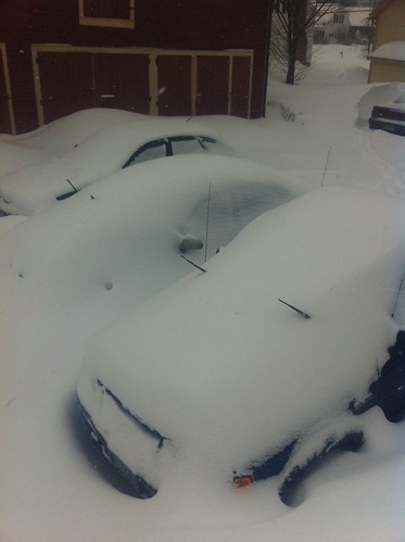
Above: Scene from last year in Vermont - this year may be much the same. Lots of snow, with temperatures just below freezing, would be great for creating more icicle art this winter.
As for southern California, I have an additional index I look at in addition to those listed above. I ask the oaks (or have friends do it for me). The oaks seem to think there will be a period of dry weather this winter. However, there has been some October rain already, and drought years rarely have much October rain. I expect precipitation will be below average, but also that there will be a decent snowpack in the mountains due to slightly colder than average weather. I don't think this will be an extreme drought year, because I do think there will be one or two periods of heavy rain. I'm going to take a blind guess - late December-early January, and early March. I'd also guess there may be some low elevation snow - perhaps on Boney Ridge in the Santa Monica Mountains, in Newhall, in Redlands, or somewhere else of that sort. Just for fun, let's say... early December.
As for Pittsburgh... well, I don't have that much experience watching the weather there, but I would guess there will be a stormy year, but not as cold as last year, which would mean a lot of sloppy, slushy, messy storms. Hopefully I'm wrong about that.
In any event, it will be fun to look back in the spring and see if I was right about any of this... if you have a prediction, post it in the comments.
Thank's you are putting impressive information about the weather.I very much appreciate your valuable research.
ReplyDelete