
The dry conditions continued for a while after I made that post, but last week it started raining. The rain started with an overnight drenching on the night of the 9th, amounting to an inch of rain around the Middlebury River watershed. On the 11th much of Vermont was relatively dry, with only a few scattered thunderstorms. However, a slow-moving severe storm formed near Middlebury and moved right up the Middlebury River, through East Middlebury and Ripton. The storm dumped an additional 2 to 3 inches of rain in the watershed, in about an hour!
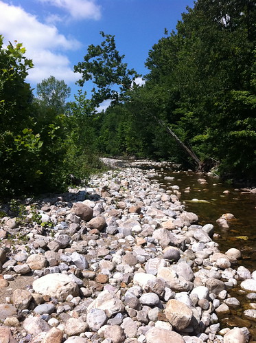
In two days, the river went from looking like this:
To looking like this:
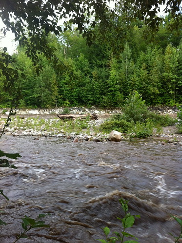
Water levels rose very close to the level we experienced during the heavy spring flood last May. And that's not all...
The storm came into town with a raging updraft that would have made me concerned about a tornado if it was rotating. I tried to take a video of the clouds sucking into the storm, but it didn't come out very impressive looking. Like many storms that move through this area, it appeared that the worst would go to the north of us, but when the storm hit the Green Mountains it shifted south. The updraft appeared directly over us, and after it passed by the rain started. Rain quickly became torrential, and appeared to be associated with a weak microburst - pouring rain blew sporadically around the area, the winds shifted quickly, and several tree limbs came down. After the wind died down, the heavy rain began to get louder... it was being accompanied by hail.
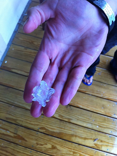
The hail started out fairly small and had an odd lens shape.
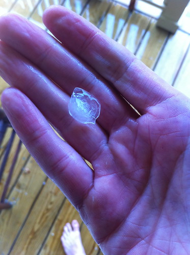
but it was increasing in size...
Note the rings of white and transparent ice. These indicate how the hailstone moved through the thunderstorm updraft, probably the same very strong one I had noticed a few minutes before.
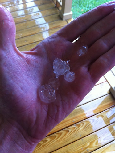
The hail got bigger, and spiky-looking, perhaps due to smaller hailstones freezing together:
Some ended up larger than quarters, qualifying as large hail and a severe thunderstorm.
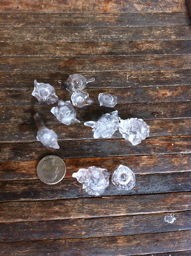
There was no damage to cars and minimal damage to our garden, though the farmers at Elmer Farm told me there may have been some crop damage there. I sent a picture and report to the National Weather Service, and others in the area did as well, as there were several reports of quarter sized hail east of Middlebury and up towards Ripton.
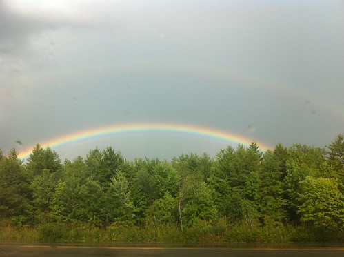
As the storm moved away, we were treated to a beautiful rainbow.
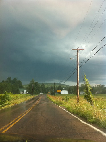
The clouds did not seem to turn as greenish or orangeish as I have observed during other hailstorms, but they sure looked nasty, even as the storm moved away.
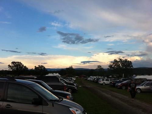
From much further off, at the Addison County Fair that evening, the distant storm clouds were beautiful, and lit up in the evening sun...
After this thunderstorm dropped 2 inches of rain, we had an additional soaking over the last 3 days due to a slow moving and wet storm that drenched much of New England. As of yesterday evening we'd had an additional inch and a half of rain, but heavy rain continued well after I checked the rain gague. So, we may be near 6 inches of rain in the last week. Other areas of Vermont didn't get quite as wet, but needless to say the dry spell has ended.
That's a beautiful photo essay and great pictures! Don't think I've ever seen hail that size.
ReplyDeleteThanks! It was pretty crazy and neat to see but I don't want to see any bigger hail because if it got much larger it probably would have started doing damage to cars, not to mention the garden! As it was it held up pretty well...
ReplyDelete