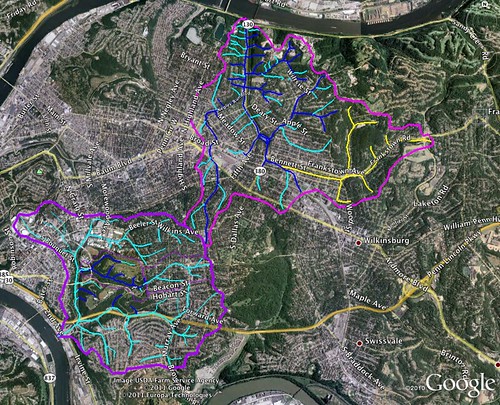
Negley Run is the northern of these two watersheds, and Junction Hollow the southern. Note that the colors mean different things for each map (oops). For Negley Run, the dark blue lines are creeks that appeared on historic maps while the light blue lines are areas that probably had flow based on topography. The yellow/orange channels around Penn Hills appear to have drained into Negley Run but the water that falls in that area is now routed into the Nine Mile Run 'sewershed'. So, in a way, Negley Run is even 'beheaded' like Panther Hollow run is, although there is no aboveground stream to offer evidence of this.
Anyway, here's the Google Map:
View Negley Run Historic Channels in a larger map
Notice just how much area of dense urbanization drains down towards Washington Avenue. Imagine two inches of rain in an hour, over that whole area, being forced into old sewage pipes that were possibly build before all that development was in place. All of that sewage water was pouring towards the river, but the system got overwhelmed, or clogged, with horrible tragic results.
Negley Run doesn't have a visible creek, and to my knowledge doesn't have a watershed advocacy organization. It's still important to the people of Pittsburgh though, if for no other reason than the fact that in its current state it is dangerous. For that reason, the watershed health of Negley Run is every bit as important as that of Junction Hollow and Nine Mile runs.
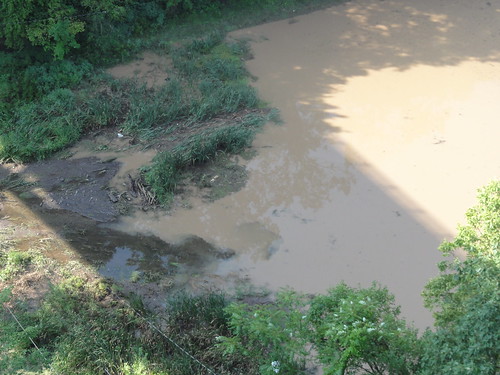
On a side note, Junction Hollow was impacted by this flood as well. Check out these pictures, taken by Martha Riecks, of Panther Hollow Lake after the deluge.
I wonder if the water got high enough in the lake to overtop into the historic Four Mile Run channel beyond...


No comments:
Post a Comment