
While walking along the river during a thaw, I encountered a small trickle of water flowing into a hole in the ice. I'd found a tiny moulin! "Real" moulins form on glaciers, when melting water pooling on their surface plunges straight down into a hole, right to the bottom of the glacier. Sometimes these plunge downward with such force they erode potholes in the ground underneath the glacier - a process that probably has influenced the terrain of Vermont as glaciers melted away during the end of the Ice Age(s).
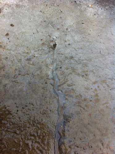
My moulin was not nearly as impressive, as seen above (i should have remembered my food coloring!). In contrast, this photo below, from NASA, shows a picture of a moulin in Greenland as viewed from above.
A little bit downhill from where my moulin had formed, the little trickle reemerged, flowing on top of ice and bringing with it sediment.
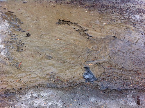
Although it was a bit odd in that it was flowing on top of yet more ice (and even seems to enter another moulin in the background as it flows away from the camera), this little trickle had essentially formed a braided channel just like the ones that form when water emerges from within real glaciers:
View Larger Map
Later on my walk I found something else very neat. A 'delta' had formed where a small trickle of water flowed into the river during our late January rain. Because the soil was frozen beneath the sand, the water was not able to soak in and instead carried away some of the top layer of sand. When the trickle met the river the water slowed down and it deposited this delta. Later, the river level dropped as the rains ended, and the delta was left in this odd perched form:
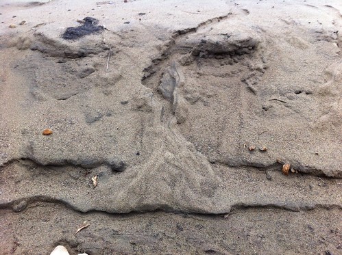
In fact, this little delta is very similar to larger deltas that formed when rivers flowed into glacial Lake Vermont, the Champlain Sea, and other now-receded bodies of water that formed as the last Ice Age ended. East Middlebury may be built on one, and Bristol, just to our north, definitely is. While the New Haven River has since eroded a big gully right through it, you can still make it out on the topographic/shaded map below:
View Larger Map
Today, while walking along Lake Champlain in Burlington, I came across one of my favorite things - water flowing through sand. I diverted a bit of the water to watch it cut a little channel and took this video of 'backcutting' - another feature that can also occur in large rivers.
While backcutting can happen when people lower part of a river (for instance, if they dredge or channelize it), it can also happen in natural settings. A very prominent example is Niagara Falls, which is in fact eroding backwards very quickly (geologically speaking). Eventually the waterfall will probably erode backwards far enough to drain Lake Erie - but we won't get to see it unless we live 25,000 years.
Incidentally, I also added quite a few plants to iNaturalist while I explored the abandoned port along Lake Champlain's waterfront in Burlington. Last winter I visited the same area and used Project Noah to do the same - but I have come to prefer iNaturalist, which has many more useful features both for tracking occurrences by species, and for tracking observations by date or location. Not that Project Noah doesn't have its upsides and advantages - it's great for casual nature observation, but I am of the opinion that for more serious citizen science and professional scientists, iNaturalist offers more.
And finally, an unwelcome sort of flowing liquid - I noticed that a maple tree in my neighborhood actually had flowing sap dripping from some of its branches today. This is very early for the trees to be 'awake', and this weekend may see an arctic blast with temperatures right back to zero degrees, so the trees may be damaged. Hopefully I'm wrong. Either way, I made sure to eat the sapsickle - as they form evaporation concentrates the sap a bit, giving the ice formation a mild syrup taste.

February 14, 2012 update: yesterday along the river I found another very neat micro-landscape. There had been a dusting of snow overnight and the sun had melted almost all of it but a few patches remained in the shadows along this bank:
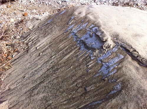
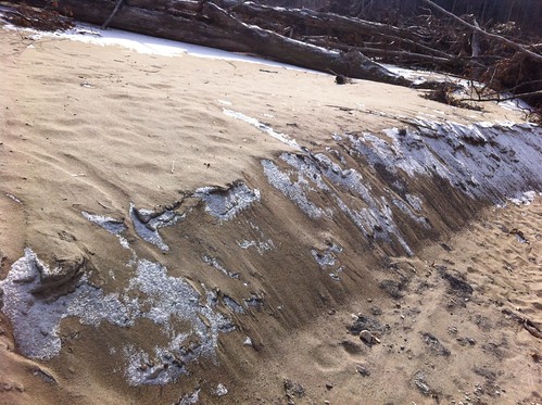
Altitude isn't a factor here, but aspect and shadowing sure are! This scene looks just like something you'd see in the mountains of the dry West.
View Larger Map
I created a flickr set for these little microcosms, and perhaps I will find more soon.
No comments:
Post a Comment