
This summer, Vermont's weather has been defined by the intense heat and drought to our south and west. When the excessively hot weather pattern moves over us, we experience miserable heat (few people here have air conditioning, because it doesn't usually get very hot!). When the cooler air inevitably fights its way back into Vermont, it butts up against the very hot and humid air, creating violent thunderstorms. This pattern has recurred several times this summer so far. We experience beautiful, sunny days and chilly (mid 40s!) nights like today, but heat and humidity steadily increase each day until Vermont feels like an oven, or like Atlanta in the summer (which is hotter?). Then, we experience violent storms and the next day the cool weather returns.
It's been drier than usual, and this compounding with the heat has lead to somewhat droughty conditions. The rivers are running low.
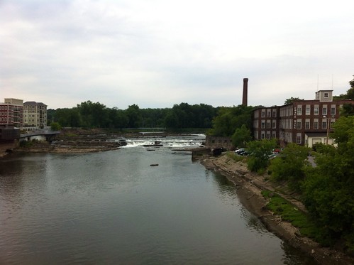
Above: the Winooski River near downtown Winooski
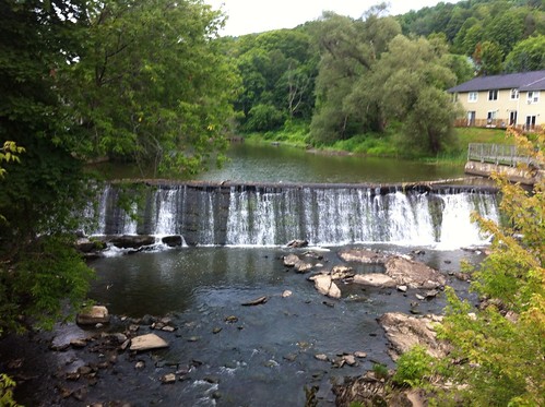
Above: water trickles over an old mill dam at the North Fork of the Winooski, well upstream in Montpelier.
This is the lowest I've seen these rivers. I haven't been to the Middlebury River since we moved away... but I'm guessing it also got pretty low in some of the warm periods.
Vermont needs the rain, but our dry conditions are nothing compared to the drought gripping most of the country. On the edge of the hot air mass, we have picked up enough storms to keep most of Vermont out of severe drought, but these storms have been spotty, and some areas have been quite dry.
Above: Drought map from the NOAA Climate Prediction Center. The summer monsoon has brought some relief to the Southwest, but the drought seems to be spreadingnorth and east. Will it make it to Vermont? I hope not!
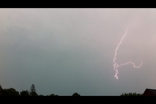
Last Tuesday was Vermont's most recent bout of severe thunderstorms. They moved into Montpelier late in the afternoon, and the mix of the severe storms (which are often weird colors to begin with due to hail within the clouds and other factors) and the backlight of the evening sun led to some dramatic skies.
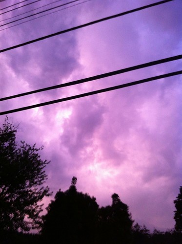
As the storms moved in, the air was incredibly hot and muggy - over 90 degrees, with humidity well over 50 percent. The freakish heat and odd humidity reminded me of a fever - sticky, sickly, and fundamentally out of balance. That sort of heat and energy, when combined with abutting cold air, can lead to incredibly violent weather.
Many areas experienced wind and hail, and perhaps some flooding. Montpelier escaped these, but was surrounded by extremely intense lightning. It was frequent enough that I was able to get some videos using my iPhone and 'movie' screen captures.
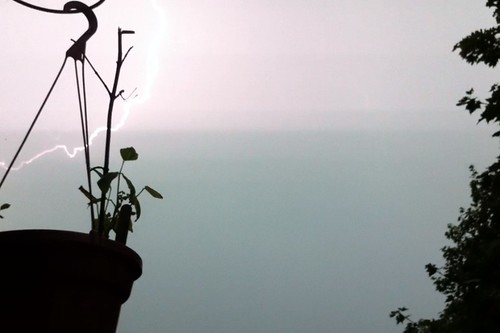
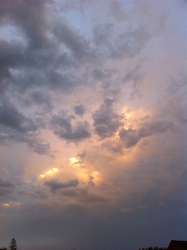
After the sun set, another wave of storms moved through. This time, the lightning was behind the rain, resulting in a sheet lightning effect. Most of the storms moved just to the south, right up the north facing slopes above the Winooski Valley. The lightning was incredible. At times, there were flashes every four to six seconds, rhythmically, pulsing twice like a heartbeat. I have no idea what made the lightning so periodic, because usually lightning seems more chaotic in timing. It was incredibly surreal.
Above: sheet lightning lights up the sky.
The storms have followed similar tracks with each summer wave, and the heavier rain (if not the lightning) has generally been missing Montpelier.
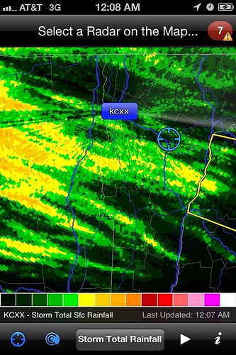
Above: estimated precipitation totals from the RadarScope app.
This image mirrors what other storms have done this summer as well. Most move south of town, with a few moving north of town. Our location has been rather dry. For whatever reason, the storms seem to be favoring Burlington, which they historically tended to avoid. Despite that observation, climate records show that Burlington on average gets about two thirds of an inch more rain each July than Montpelier, even though June and August are equally wet in both places. Montpelier, in return, averages a bit more winter precipitation, and a bit colder temperatures, which means about a foot and a half more snow. Perhaps more importantly, thaws with south winds can't work their way into Montpelier as readily as Burlington, meaning the snow stays on the ground longer too.
So, despite the dry times right now, we'll have more snow to play in come winter.
Meanwhile, I hope we avoid any ill effects from the severe storms we may get through the rest of the summer. After Irene and other weather disasters hit the state last year, we need a break!
Best of luck to those dealing with more serious heat and drought to our south and west...
No comments:
Post a Comment