
The first thing I realized once I got to the newly exposed riverbed was that I wasn't the only one exploring the area. One of the local red foxes was also poking about in the sand, perhaps looking for stranded fish.
(hard to see but the fox is in the center of the photo.)

As usual with foxes, it kept to itself but didn't seem too concerned with my presence either.
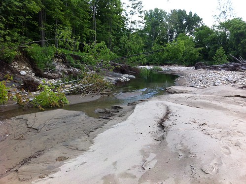
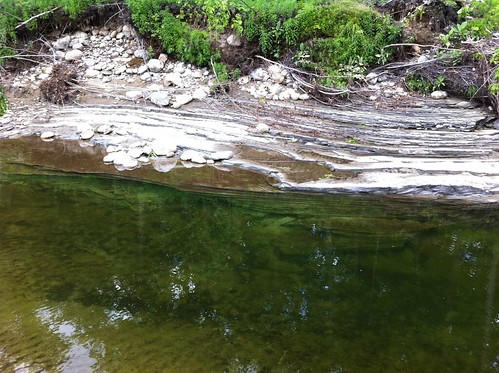
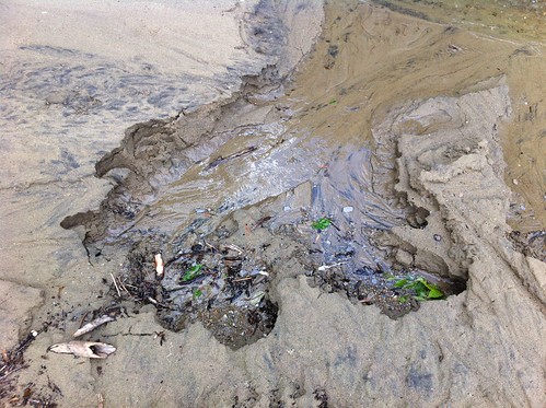
The experience of exploring the riverbed reminded me a bit of southern California, where most rivers dry to trickles and pools, or dry up completely, in the summer. There was a small trickle of water here, which was forming an interesting little 'delta' in the old swimming hole...
It was feeding this small, stagnant pool, which had mostly filled with sand and silt. This was our swimming hole last year, but this year it isn't looking promising.
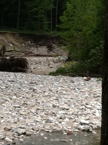
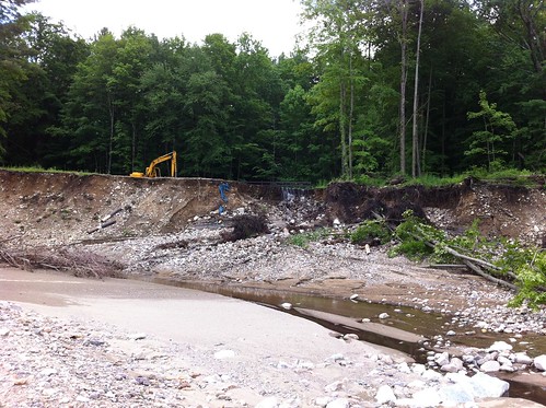
Here's how the area looked just a few weeks before:
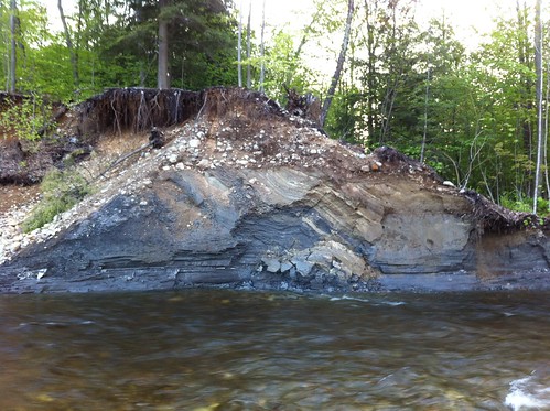
There was still water in the riverbed, but none was flowing in from the river upstream - the new cut had dropped the river level by several feet and a fresh deposit of gravel blocked the old channel. So where was this water coming from?
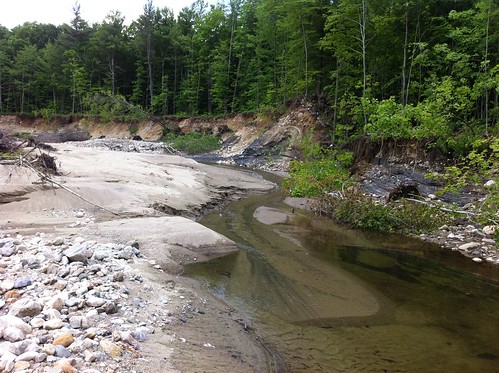
Some of the water was coming from these new seeps:
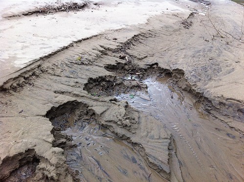
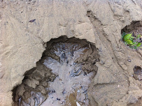
Undoubtedly, before the river shifted the water table was quite high in this area. When the river shifted the surface water drained away quite thickly but the sand bars were still draining into the riverbed. It seems likely that these seeps will eventually dry up.
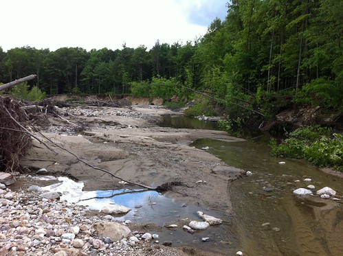
Upstream from the seeps there was still flowing water. As I walked up the small stream I heard the sound of falling, splashing water. To my surprise, there was water pouring down the riverbank:
I'd walked this stretch of river probably hundreds of times, including after very heavy rain, and I'd never seen water pouring down this bank before. It hadn't rained in a while so it wasn't just runoff. All I can think of is the flash flood must have shifted the path of a creek up the hill, that used to join the river further downstream, causing it to flow into this area instead. It looks like the little creek is set to cut quite a gorge into the pasture up the hill unless it is diverted back into its old path (which is often difficult if not impossible).
I'd like to explore what happened upstream, but I don't know the people who own the land up that way and didn't want to trespass. So I explored further up the riverbed instead.
I'd like to explore what happened upstream, but I don't know the people who own the land up that way and didn't want to trespass. So I explored further up the riverbed instead.
Upstream from the small new stream the riverbed was completely dry.
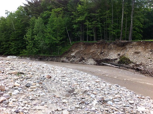
This had been one of my favorite stretches of river... a long meandering bend with a nice gravel bar on the inner river edge. It's not a river anymore, and because this river is steeper than most meandering rivers, this won't convert to a wetland like most oxbow cuts. Instead, I think it will turn into a sycamore and sugar maple floodplain forest, if the invasive plants don't disrupt things too much. Though if there were a seed source I wouldn't be surprised if a pitch pine or two popped up in the area also.
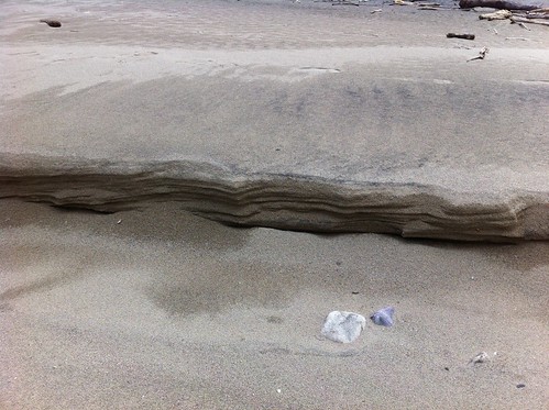
In the mean time, it is a desert of sorts - although it is a very wet area, any rain that falls soaks through the sand immediately. The actions of water and wind have sculpted the sand into formations that remind me of the desert out West:
There are new piles of logs in the area too, but it doesn't seem like the quantity has increased here. The logs that Irene left in the area seem to have mostly rotted and crumbled in the flash flood, and have washed away to be replaced with these.

The exception is the oxbow cut area - as the river continues to expand its path through the forest, the area should be clogged with trees for a while. Not great for swimming holes and an occasional hazard for the occasional kayaker who tries running the river during high water but also great fish habitat.
The recent changes in the river are both fascinating and also difficult at the same time. We usually don't think of landscape figures like rivers as things that change over time, but in fact rivers are very dynamic systems, especially where they emerge from mountains into wider valleys. I've often gone to the oxbow site to think about the inevitability and unpredictability of change in our lives. Like so many other changes, this one seemed to take forever to happen, and when it did, it felt sudden, a bit unreal, and a little bit sad. It seems appropriate that the river shifted just a few weeks before we will be leaving East Middlebury and moving to another river town. Like the river shift, the move is coming fast, and I feel sad about leaving this town that I have come to love, but excited about future possibilities as well.
Change comes whether we want it or not, and we rarely are able to choose either the time or the place. The river offers an important lesson about appreciating the present, but learning to weather and even appreciate the floods, and enjoying the promise of the future regardless of where the next sand bar or fallen log appear.
Hey Charlie, I know you're not a birder, but I wonder if you have noticed if there are there any Bank Swallows nesting in that exposed section of riverbank?
ReplyDeleteI haven't noticed any there. I'd see them flying around too, right? The bank was very actively eroding which perhaps kept them away, but now that the river has shifted, maybe some will move in!
ReplyDeleteThey would be pretty obvious. Definitely looks like a future site for them.
DeleteYou know I hate to see photos of erosion and destruction of beautiful ecosystems, but the shots are still beautiful.
ReplyDeleteAmazingly, over in Anza where I use to live I was hiking down Horse Canyon which leads into Coyote Canyon towards Anza Borrego State Park and there were some crumbling canyon wall cut by erosion for which the geology of the high walls was all compressed sediment. I was amazed that these birds made nest right there in the exposed open on crumbly decomposed granite and cobblestone.
On another note, you may like this if you've not already seen it. The first thing that came to my mind is Viktor Schauberger and then you
Mississippi Historical Meangering Map
Kevin
--