
This January's thaw, though, is a tricky one to a put a finger on. Why? We've already had several thaws, complete with rain and temperatures reaching above 40. We've also had several respectable if not unusual cold snaps, with temperatures below zero throughout the state. In fact, just two days ago I was up in Hyde Park and the temperature got down to -16. The Lamoille River was steaming as if it was boiling, because the contrast between flowing water and subzero temperatures was so great. Now? It's in the mid 30s, the temperature is still rising, and the radar (and my earlier walk by the river) tells me it will be raining soon. The rain will not be able to soak into the ground (despite the several thaws of this month, the ground is frozen deeply due to lack of snow cover, and will not thaw from this warm spell) and the river will undoubtedly rise. Although 36 hours of temperatures in the mid to upper 30s is not enough to melt all the ice formations around the river, the raising water will be enough to rip much of the ice loose and perhaps create some small ice jams. This storm isn't nearly as strong as the one two years ago, so I doubt any ice jams will be big enough to cause problems.
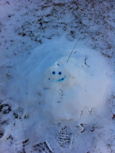
(above: the little Snow Monster, more on its fate to follow...)
So, is this the January Thaw? It's at the right time of the year, so I'm tempted to call it that, even though these thaws and subsequent ice-ups are all too familiar this year. The thaw will probably do what all the other thaws have done so far - remove the inch of snow outside (it's already half gone), create puddles, then turn to ice and maybe drop a bit of snow as colder air moves in. This time the transition to cold air won't be as fast, so it won't be as icy as last week, hopefully.
And this brings me to the snow monster. Last year was very snowy, and I spent a bit of time shoveling a walkway in Middlebury. Much of what I shoveled ended up on top of a pile of snow that had slid off the roof, leading to a huge mound of snow. Before the first big thaw, I gave it arms and eyes and declared it the Snow Monster. I wanted to see if the snow monster would survive this thaw. It did... barely:
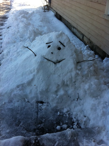
Before
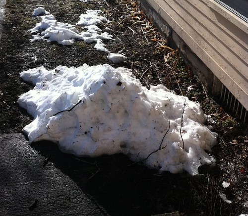
After
Despite all the snow last year, that snow monster had the misfortune of being created both next to a south-facing wall and under the eaves where warm rainwater dripped all over it. This year's snow monster is smaller than last year's snow monster, but it's in a shady area away from rooftop runoff. It was created in late December and has not completely melted during any of the other thaws, so I think it will survive this thaw too.
Then again, there is an off chance of a thunderstorm moving through tonight, and a warm downpour from a thunderstorm could be enough to do the snow monster in. We'll see!
What do you think? I'll post the results when temperatures drop below freezing again.
Nice read. Appreciate your time to share your thoughts.
ReplyDeleteInteresting thoughts you have there.
ReplyDelete