
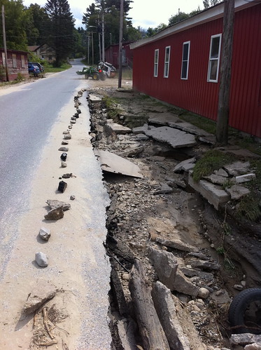
Yesterday I felt like I was doing a bit too much typing and talking and not being helpful enough, so I went with two friends to Brandon to see if any help was needed. We were sent to a rural road where a wood shop owner asked us to help direct cars away from undercut sections of road. The flood had heavily eroded this small country road, but there was a lot of traffic as people tried to find their way around. Apparently Brandon was totally out of traffic cones. So, this meant that we had to use what was available - rocks and flood debris - to mark off where the road was hazardous.
(more below on Brandon and Addison County)
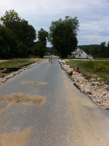
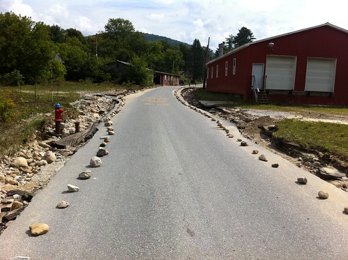
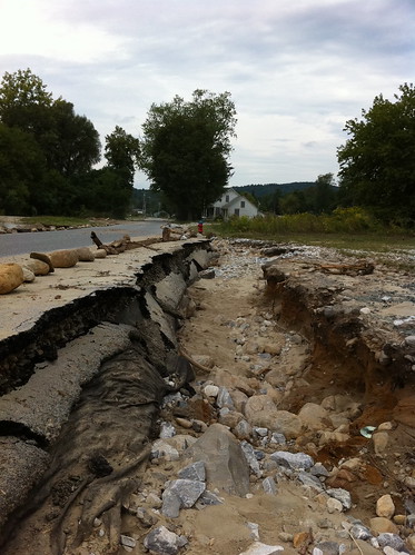
Hopefully this prevented anyone from driving off the road. It may be a while since this is fixed, it's probably pretty low priority considering the extensive damage to major roads in the area.
We also visited downtown Brandon. As of yesterday, there was a detour on Highway 7, but it was possible to access downtown via Park Street. Rumor has it that 7 may be re-opened soon. Either way, many shops and restaurants are open, so if you were considering a trip to Brandon, please don't cancel it on account of the floods. The businesses could use your support! If you aren't planning to come to town, but still would like to help, you can donate to the Brand Aid fund.
When we visited Brandon we didn't find just destruction, but also a bunch of neat shops and restaurants that are only 20 minutes from our house. We're hoping to go check some of the restaurants out soon.
Salisbury Flooded Fields
These fields, in Salisbury along Highway 7, often flood in spring, but don't usually flood this time of year. I'm not certain if there will be crop damage, or if the field was laying fallow.
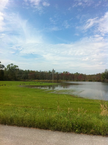
The flooded fields reminded me of some of my ideas about controlling floods - this water was slowed down on its way to Middlebury, decreasing the flood crest there. It also made me think of a Neko Case song called Fox Confessor Brings the Flood:
Driving home, i see those flooded fields
How can people not know what beauty this is?
I've taken it for granted my whole life,
since the day I was born.
It's amazing to me that even in a time of destruction, Vermont is possibly the most beautiful place on Earth. Some of the red maples on the edge of this field were turning red, perhaps stressed due to the unexpected water. The maples were reflected in the calm of the flood. I hope the farmer who grows food on this land was not harmed by the flood, but I also thought it was important to pause and notice the moment of beauty.
Incidentally, Neko Case lives in Vermont and has been offering information and support on her twitter feed.
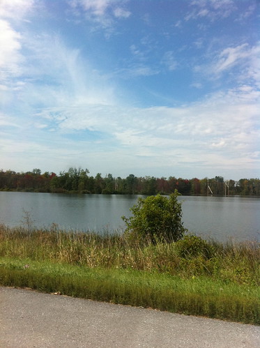
Middlebury
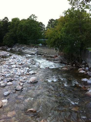
Otter Creek in Middlebury is peaking, or just past peak, right now. Last I heard there was the possibility of some minor flooding at Jacksons By The River and in Frog Hollow, but the city will mostly avoid flood troubles. Here's what the river looked like yesterday:
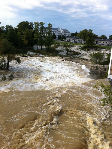
East Middlebury
There was some heavy equipment working near the Grist Mill road in the riverbed today. The equipment is probably cleaning up/repairing the small flood wall in the area, which protects the town from floods. I'm glad they are doing this promptly since there is a chance of more fairly heavy rain on Monday and Tuesday. Thanks to work crews for their rapid response to this problem!
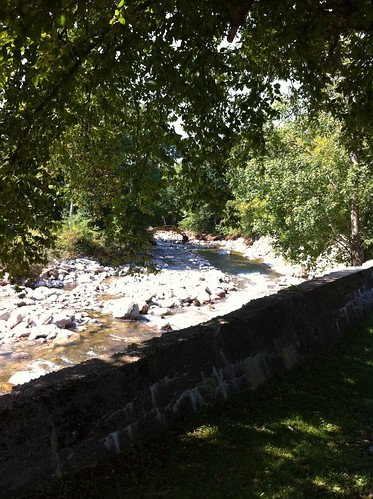
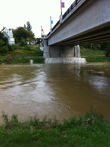
Above: the river under construction. Below you can see the concrete flood wall near Grist Mill Road. It's hard to see on the photo but there is some damage in need of repair, which is why there is work happening in the river.
No comments:
Post a Comment