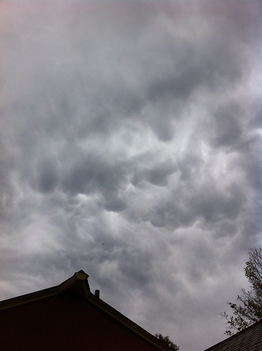
Above: mammatus clouds on the last evening of April, marking the start of a wet May.
Early last week, a drenching rain dumped water on already-wet soils, causing the rivers to rise. The Middlebury River was nowhere near the levels reached during Tropical Storm Irene, but the water was perhaps the highest it had been since that storm, since we didn't have much of a spring snowmelt season this year. I didn't get a picture of the river at its highest, because the waters peaked at night, but below you can see the river as the waters rose.

The high water flowed through vast deposits of sand and gravel moved about by Irene's flooding, as the river set into a new course. Swimming and fishing holes were scoured out, a few crumbling banks gave way, and the river acted how one would expect after two heavy inches of rain, but the water stayed in the lower floodplain. Despite all of the concerns circulating after Irene, I don't see any evidence that there is 'too much' silt in the river. The big floods bring in the silt, and the smaller ones move it away. Over the longer scale, the movement of sediment is certainly an issue, and a good plan will help the city of East Middlebury determine the best way to coexist with the river. In the mean time, the most important thing is to make sure the structures protecting homes, roads, and businesses are solid and well-maintained.
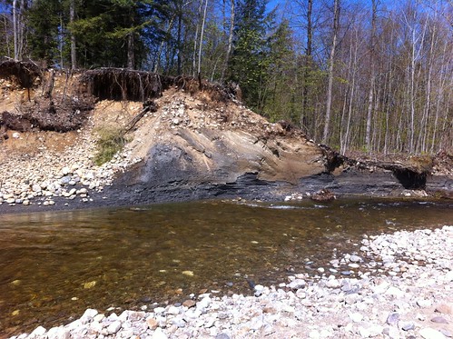
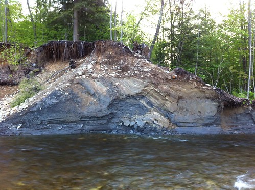
There is an interesting bank on the river where sediment from an ancient post-ice-age lake is exposed. The high water caused another chunk to fall off of this eroding bank, revealing a look at a new part of the sediment, that no human has ever seen before these rains:
I recently posted a link on Facebook and Google+ about the oxbow (river bend) that is being cut off by erosion. The river bend described in the post linked above was almost cut across by Irene, but once the floodwaters dropped and winter set in, very little erosion happened. This seemed to mainly be due to the many tree roots in the soil as well as the root ball of a sycamore and a maple that was holding back the erosive forces of the water:

The recent flood blasted right through these roots. I went to visit the oxbow cut as the water was rising, and you can see below by the alignment of the logs on the opposite bank that some of the oxbow had already been eaten away:
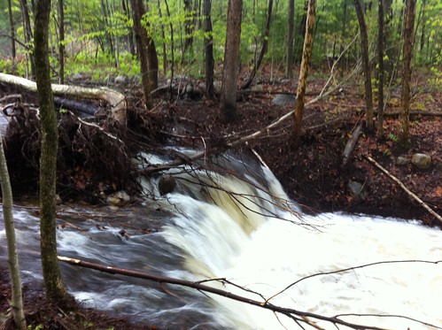
After the latest high water event, the 'cut' (the small, backwards-eroding waterfall) had eroded upstream so far it wasn't visible in the same place:
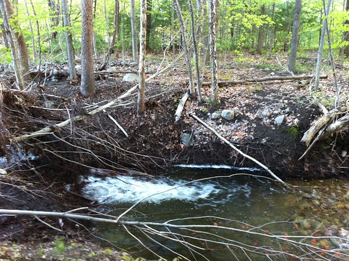
Below you can see that the cut has eroded beyond the area protected by tree roots, and has undermined the downed trees in the river.
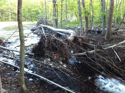
Beyond is the main flow of the river. It won't be long now before the river shifts, because the new channel is lower, and a more direct path, than the existing channel. Rain is forecast this week, with a couple of inches possible, and I'd not at all be surprised if by next weekend the river has a new route.
The slow rate at which this oxbow has been cut shows just how powerful trees are in reducing erosion of riverbanks, both when they are rooted in the bank and when they have fallen. Any removal of 'debris' or cutting of live trees hanging over the river in this area would have resulted in this erosive process having happened much more rapidly. In this particular case the shifting of the river is occurring on an unpopulated floodplain, but in many cases trees are removed from riverbanks near homes and roads. There can be good reasons to removed downed trees from a river, for instance if they are jamming under a bridge and causing a danger of bridge failure, but in general we should think long and hard before doing so.
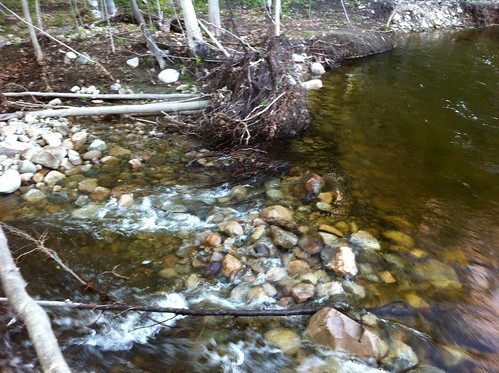
Above: a root ball of a fallen tree keeps the river in its current path... for now.
The imminent shift of the river doesn't appear to be a threat to any structures nearby. I am not sure who owns this area of land, and because property lines do not move like rivers do, it could cause land ownership confusion as dry land and the river switch places. No one owns the riverbed, but when the river moves, and old riverbed becomes dry land, does the owner of the new river get the old riverbed? Does one person get more land and the other less? I don't actually know the answer to these questions, but I'm sure they are coming up all over Vermont in the wake of Irene. It's not really possible to keep a river in the same place in the long term, but it's no easy task to move our lives around as the river moves. Some people who live near rivers have adapted their cultures to simply move with the river, but that doesn't work very well with Vermont's brick and old-mill architecture. In some cases we can convert floodplain land back to open space, seasonal farmland (like the Intervale in Burlington, which floods on a semi-regular basis), or perhaps some sort of fiddlehead, venison, trout, and firewood working landscape permaculture - rather than the normal US dichotomy of factories, concrete, and factory farms or untouched and untouchable 'wilderness'. Still, in many cases our towns are built right on the rivers, so we just have to do our best to protect ourselves and let the river do its thing (because that is going to happen regardless).
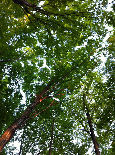
Above: maples in the May evening light. Could a floodplain be used for production of numerous forest resources (syrup, fiddleheads and other edible plants, trout, venison, firewood, recreation, and flood control) and provide livelihoods as well as ecological value?
In any event, the oxbow cut is a place I go to reflect on the often unpredictable but always inevitable nature of change. In the short term, and in the long term, rivers will shift. People could try to stop it, or could speed up the process, but it will happen regardless. The Middlebury River flows through mountains that formed long before the first dinosaur set foot on this planet, and the river has probably meandered across the Champlain Valley in every interglacial period of the last few million years. When the ice comes, the river flows beneath the glaciers, and when the ice melts it is uncovered. Of what consequence is a mill dam, levee, or concrete lining to a river that has seen hundreds of thousands of storms like Irene, and even more massive floods unleashed by the melting of glaciers and release of glacial lakes? If we 'damage' the river, we simply put ourselves in danger or throw away the chance for us and our children to enjoy it. The river will continue to be a river long after our species is forgotten or has moved on to something else. The more we understand it, and make its natural processes a part of our life, the more of a resource to us it can be. Long after everything we have built has rusted away and crumbled, the river will continue to wander across this wide valley carved into our planet.


Hello there! What is yous point of view on commercial pop-ups of any kinds placed on personal blogs?
ReplyDeleteKind of a random question, are you just trying to get clicks for your blog? I am fine with adds but don't like those that make noise or obstruct view of the screen, so no i am not a fan of pop ups.
ReplyDelete