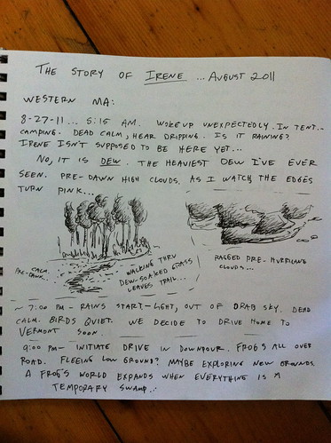
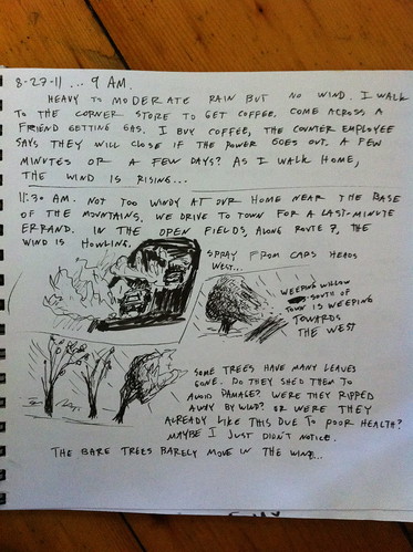
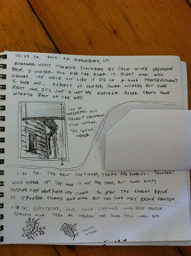
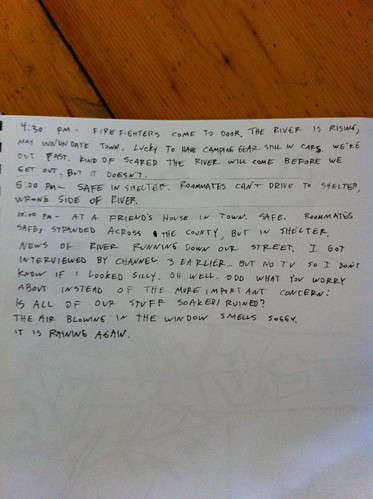
During Hurricane Irene I recorded some observations in a notebook, along with a few little sketches. It's not the most detailed journal, and doesn't have all that much art (how do you draw a hurricane?) but I think it's interesting so I am posting it here. The most notable thing I observed, I think, is the fact that in many areas, such as East Middlebury, the storm didn't seem like THAT big of a deal... and I wrote something to that effect, and then minutes later the fire department came to our door and told us we had to evacuate before the river went down Main Street. This has been echoed by others in other areas, and speaks to the fact that flash flooding is dependent on what happens upstream, not just what happens where you are.
Also, I noticed an interesting smell when driving through the start of the storm, and have heard elsewhere that others observed the same thing... did anyone else smell anything interesting or out of place during the approach of the storm?
The journal starts in the Berkshires of Massachusetts, and then moves to East Middlebury, Vermont.


This comment has been removed by the author.
ReplyDeleteHi Charlie,
ReplyDeleteI got here from the What if article, but then got interested in your posts on slow water movement and Irene. I wonder if you know of Ben Falk and the Whole System Research Farm up in Mad River Valley?
He's posted some pretty inspiring videos comparing the water moving through his farm during the storm (slow, clear, mostly soaking in) versus the flows in the Mad River at the same time (full sediment load, living up to its name).
His website (http://www.wholesystemsdesign.com/) is down at the moment, but here's a short video of that comparison: http://vimeo.com/57208305. There's a longer discussion of it in his TEDx Talk: https://www.youtube.com/watch?v=CKND0131d3g (pictures are better in this version - the official TEDx video was recorded by a handheld camera from the back of the room: http://tedxtalks.ted.com/video/The-Resilient-Farm-and-Homestea).
Really interesting discussion of the way water moves in video games too, by the way - I've tasked my kids with experimenting with it and reporting their results.
David Field
CAD Technician
www.interfluve.com
Wow, thanks so much for that link. Oddly I haven't seen their site - they are not far from my location at all. Looks like they are doing some very neat and good stuff. I followed them on Facebook and look forward to learning more and maybe collaborating with them at some point.
DeleteRight now (among other things) I am looking at restarting and focusing more on a project of making video games that simulate things like ecosystems and water and often are fun to play. I love games like minecraft but don't like how the environment is just a passive backdrop at best to manipulate and at worst not even connected to the player. More to come... and really glad you enjoyed the blog and the What If.
Our sons have recently started playing around with the Unreal Development Kit. I'm not a gamer myself, but UDK looks like a pretty powerful tool, and it's free. I'll see what they say about controlling water flow dynamics in that environment.
ReplyDeleteWatching them "paint" vegetation onto a terrain reminds me of a demo I saw last year of Autodesk's Infraworks 360. Between aerial drone surveying coming online in 2015 and recent improvements in handling massive point cloud datasets, I think the models you and I use in our work are about to get a lot more detailed. I live and work in the Columbia Gorge, and I'd like to try importing LiDAR data into UDK to create a pre-hydropower virtual model of the Gorge.
Hmm. not sure if my last post 'took' or not. Posting this to test. But yeah I have been using Unity which sounds similar to Unreal Development (maybe you saw the blog post about it) and the newer mapping tools are incredible though Vermont sometimes lags behind other places.
ReplyDelete